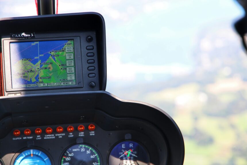
GPS Navigation: Guiding Aircraft with Precision
The modern aviation landscape is a testament to human ingenuity, and at the heart of its safety and efficiency lies the Global Positioning System (GPS). Once a military-exclusive technology, GPS has revolutionized air travel, transforming it from a journey reliant on celestial bodies and ground-based radio beacons into a highly precise, automated, and continuously monitored operation. This pervasive technology provides aircraft with an unparalleled level of positional awareness, enabling pilots to navigate complex airspace with confidence and airlines to optimize flight paths for time and fuel. The story of GPS in aviation is one of gradual integration, rigorous testing, and ultimately, unwavering reliance. It has moved from being a supplementary tool to an indispensable component of flight operations, ensuring that aircraft arrive at their destinations safely, on time, and with remarkable accuracy.
The journey of GPS from a nascent military project to a cornerstone of global aviation is a fascinating narrative of technological progression and diplomatic collaboration. Its initial development was driven by the United States Department of Defense, with the explicit goal of providing precise global positioning for military assets. However, the inherent capabilities and accuracy of the system quickly became apparent to civilian sectors, none more so than aviation. The potential for enhanced safety and efficiency was undeniable, spurring a concerted effort to adapt and integrate GPS technology into airborne systems.
Early Adoptions and Incremental Integration
In its nascent stages, GPS was not immediately embraced as a primary navigation system. Aircraft already possessed a suite of established navigation technologies, including Inertial Navigation Systems (INS), VOR (VHF Omnidirectional Range), DME (Distance Measuring Equipment), and ADF (Automatic Direction Finder). These systems, while effective, had limitations. INS systems suffered from drift over time, requiring periodic recalibration. VOR and DME relied on ground infrastructure that could be subject to outages, weather interference, and limited coverage, particularly over oceans. GPS offered a solution that was global, inherently accurate, and not dependent on ground stations. Early adoption focused on using GPS as a supplementary or complementary system. Pilots would use GPS to cross-check their position derived from other instruments or to navigate in areas where other navigation aids were scarce. This gradual approach allowed for the accumulation of operational experience and built confidence in the reliability of GPS. The Federal Aviation Administration (FAA) and other global aviation authorities played a crucial role in this phase, developing standards, certification processes, and guidelines for the use of GPS in aviation.
From Supplementary to Primary: The Shift in Reliance
As the GPS constellation matured and its reliability was proven through extensive flight testing and operational use, the aviation industry began to shift its perspective. The accuracy and continuous availability of GPS signals allowed for the development of new, more sophisticated navigation procedures. This led to the concept of Performance-Based Navigation (PBN), a framework that enables aircraft to fly more precise, direct routes. GPS became the foundational element of PBN, allowing for Area Navigation (RNAV) routes that are not tied to ground-based navaids. These routes offer significant benefits, including reduced flight times, lower fuel consumption, and improved airspace utilization. The transition from supplementary to primary navigation wasn’t a sudden event but a carefully managed evolution. This involved rigorous testing and validation of GPS receivers, flight management systems (FMS), and the overall navigation capabilities of aircraft. The development of advanced integrity monitoring systems was also paramount to ensuring that pilots were alerted to any potential GPS signal degradation or errors. This allowed for a seamless and safe transition, where GPS, augmented with redundant systems and robust error detection, became the preferred primary means of navigation in many operational scenarios.
International Collaboration and Standardization
The global nature of aviation necessitates international cooperation in the development and standardization of navigation technologies. Organizations like the International Civil Aviation Organization (ICAO) have been instrumental in establishing global standards for GPS use in aviation. This ensures that aircraft equipped with GPS can navigate safely and predictably across different countries and air traffic control regions. The development of standards for Receiver Autonomous Integrity Monitoring (RAIM) and advanced RAIM (ARIM) is a prime example of this collaborative effort. These systems are crucial for detecting and warning pilots of GPS satellite failures or signal anomalies, ensuring the integrity of the navigation solution. The ongoing evolution of GPS, including the development of more advanced satellite constellations and augmentation systems like SBAS (Satellite-Based Augmentation System) and GBAS (Ground-Based Augmentation System), further underscores the commitment to international standards and interoperability, ensuring that GPS remains a reliable and indispensable tool for global air traffic management.
GPS technology plays a crucial role in guiding aircraft, enhancing navigation accuracy and safety in the skies. For a deeper understanding of how GPS systems are integrated into aviation and their impact on flight operations, you can read a related article on this topic at In The War Room. This resource provides insights into the advancements in GPS technology and its applications in modern aircraft navigation.
The Technological Pillars of GPS-Guided Flight
The seemingly simple act of pinpointing an aircraft’s location is underpinned by a sophisticated interplay of satellite technology, ground control infrastructure, and advanced avionics within the aircraft itself. Understanding these foundational elements is key to appreciating the precision GPS brings to the complex domain of air navigation.
The Satellite Constellation: A Network in Orbit
The fundamental component of the GPS system is its network of satellites orbiting the Earth. The U.S. Space Force operates the Global Positioning System constellation, which currently comprises over 30 active satellites. Each satellite transmits precise timing signals and orbital information. Aircraft receivers, equipped with specialized GPS antennas and processors, capture these signals from multiple satellites simultaneously. By measuring the time it takes for signals from at least four different satellites to arrive, the receiver can calculate its precise three-dimensional position (latitude, longitude, and altitude) and its precise time. The constant movement of these satellites and the ongoing monitoring and control from ground stations ensure the accuracy and reliability of the signals broadcast to the Earth. This continuous stream of data forms the backbone of GPS-guided navigation, providing an ever-present and globally accessible reference point.
Ground Segment: Maintaining the System’s Integrity
While the satellites are the visible components of GPS, a robust ground segment is equally critical for its operation. This segment includes a network of ground control stations, monitor stations, and ground antennas. The monitor stations continuously track the health and performance of the satellites, collecting data on their orbital positions and clock accuracy. This information is then transmitted to the master control station, which uses it to precisely calculate updated orbital parameters and timing corrections. These corrections are then uploaded to the satellites, ensuring that the signals they broadcast remain accurate and reliable. This constant vigilance and maintenance are essential for upholding the integrity of the GPS system, providing aircraft with the confidence that the positional data they receive is trustworthy. Without this meticulous oversight, the accuracy of the system would degrade over time.
Airborne Avionics: Translating Signals into Action
Within the cockpit, a suite of advanced avionics works in concert to receive, process, and utilize GPS signals. The GPS receiver is the primary interface, capturing the satellite signals and performing the initial calculations to determine the aircraft’s position. This raw positional data is then fed into the aircraft’s Flight Management System (FMS). The FMS, a sophisticated computer, integrates GPS data with other navigation information (such as INS, air data, and radio navigation inputs), applies complex algorithms, and presents intuitive navigation guidance to the pilots. This guidance can be displayed on Electronic Flight Displays (EFDs) in various formats, including moving maps, flight plan displays, and vertical profile views. The FMS uses this integrated navigation solution to automatically steer the aircraft along pre-programmed flight paths, manage altitude changes, and optimize for fuel efficiency. The seamless integration of GPS data into the FMS is what allows for the automation and precision that define modern flight.
The Impact of GPS on Flight Operations and Safety

The introduction of GPS has had a profound and transformative impact on nearly every facet of aviation, fundamentally enhancing both operational efficiency and safety levels. Its ability to provide highly accurate, all-weather positioning has unlocked new possibilities and significantly mitigated the risks associated with traditional navigation methods.
Enhanced Safety Through Precision Routing
One of the most significant safety benefits of GPS navigation is its ability to enable precision routing. Before GPS, aircraft largely followed fixed airways defined by ground-based navaids, often leading to circuitous routes and potential conflicts in busy airspace. With GPS and the advent of PBN, aircraft can fly more direct routes, known as RNAV routes. These routes are defined by geographical coordinates rather than specific ground stations, allowing for greater flexibility and optimization. This precision routing leads to fewer opportunities for navigational errors, clearer separation between aircraft, and reduced instances of aircraft deviating from their assigned flight paths. Furthermore, GPS-based vertical guidance systems, such as those used in Category I, II, and III approaches, allow aircraft to land in significantly lower visibility conditions, a capability that was previously impossible or extremely hazardous.
Optimizing Flight Paths for Efficiency
Beyond safety, GPS has become an indispensable tool for optimizing flight efficiency. By enabling more direct routes, GPS-based navigation significantly reduces flight times and, consequently, fuel consumption. This not only translates into substantial cost savings for airlines but also contributes to a reduced environmental impact through lower emissions. The FMS, powered by GPS data, continuously calculates the most efficient flight path, factoring in wind conditions, aircraft performance, and airspace constraints. This real-time optimization allows pilots to make informed decisions, further enhancing fuel economy. The ability to plan and execute complex flight profiles, such as continuous descent approaches, which minimize engine thrust and altitude holding, is a direct result of GPS’s precise vertical and lateral guidance capabilities.
All-Weather Operations and Reduced Diversions
Traditional navigation methods often struggled in adverse weather conditions. Fog, heavy rain, or storms could interfere with radio signals or obscure visual references, leading to flight delays, diversions, or cancellations. GPS, being a satellite-based system, is largely unaffected by terrestrial weather phenomena. This all-weather capability means that flights are less likely to be diverted to alternate airports or canceled due to navigational limitations. The ability to execute instrument approaches with high precision, even in poor visibility, ensures that aircraft can reach their intended destinations more reliably. This not only improves passenger satisfaction but also enhances the overall predictability and efficiency of airline operations. In critical situations, the consistent and reliable positional information provided by GPS is invaluable for maintaining situational awareness for both the flight crew and air traffic control.
Improved Air Traffic Management (ATM)
The precision offered by GPS navigation has a cascading effect on Air Traffic Management (ATM) systems. With aircraft accurately knowing their position and following precise routes, air traffic controllers can manage airspace more efficiently. This allows for reduced separation standards between aircraft, enabling higher traffic volumes within the same airspace. Furthermore, the predictability of GPS-guided flight paths allows for more proactive and efficient sequencing of arrivals and departures, reducing delays at congested airports. The integration of GPS data into ATM systems, often referred to as NextGen in the United States and SESAR in Europe, is transforming air traffic control into a more dynamic and responsive system, further leveraging the capabilities of GPS.
The Future of GPS in Aviation: Augmentation and Integration

The journey of GPS in aviation is far from over. Ongoing research, technological advancements, and a continuous drive for greater efficiency and safety are paving the way for even more sophisticated uses of satellite navigation, ensuring its continued relevance and dominance in the years to come.
Satellite-Based Augmentation Systems (SBAS)
To further enhance the accuracy and integrity of GPS signals, Satellite-Based Augmentation Systems (SBAS) have been developed and deployed. Systems like WAAS (Wide Area Augmentation System) in North America, EGNOS (European Geostationary Navigation Overlay Service) in Europe, and MSAS (Multi-functional Satellite Augmentation System) in Japan utilize a network of ground stations to monitor GPS signals and broadcast corrections via geostationary satellites. These corrections mitigate the effects of atmospheric delays and satellite clock errors, providing a navigation solution on par with highly precise ground-based systems. SBAS enables aircraft to conduct precision approaches down to very low decision altitudes, even in challenging weather, effectively expanding the operational capabilities of airports that may not have expensive ground-based infrastructure. The widespread adoption of SBAS is a testament to its effectiveness in improving both the accuracy and reliability of GPS for aviation.
Ground-Based Augmentation Systems (GBAS)
Complementary to SBAS, Ground-Based Augmentation Systems (GBAS) offer an even higher level of precision, particularly for airport operations. GBAS utilizes a network of ground receivers at the airport itself to monitor GPS signals and broadcast corrections to nearby aircraft via a local VHF data link. This localized augmentation provides incredibly precise positioning data, enabling Category III landings (all-weather capability) and advanced departure procedures. GBAS is particularly valuable for busy airports where the precision and reliability of landings are paramount. Its ability to overcome signal multipathing issues (reflections of GPS signals off buildings and terrain) at airports makes it a robust solution for critical phases of flight. The ongoing deployment of GBAS at airports worldwide is a clear indication of its critical role in the future of safe and efficient air travel.
Integration with Other Advanced Technologies
The future of GPS in aviation is also characterized by its deep integration with other cutting-edge technologies. This includes the fusion of GPS data with information from sensors like radar, LiDAR (Light Detection and Ranging), and artificial intelligence-powered vision systems. This multi-sensor fusion approach creates a comprehensive situational awareness picture for both pilots and autonomous flight systems. For instance, in the context of developing autonomous aircraft, GPS will be a critical component, providing the foundational navigational data that is then enhanced and validated by other sensors. Furthermore, the development of advanced cyber-security measures for GPS signals is crucial to protect against potential interference or spoofing, ensuring the continued integrity and trustworthiness of the system in an increasingly connected world.
GPS technology plays a crucial role in guiding aircraft, ensuring safe and efficient navigation throughout their journeys. By providing precise location data, GPS systems allow pilots to follow predetermined flight paths and make real-time adjustments as needed. For a deeper understanding of how these systems work and their impact on aviation, you can explore a related article that delves into the intricacies of GPS navigation in the aviation industry. This insightful piece can be found here.
Challenges and Mitigation Strategies in GPS-Reliant Navigation
| Aspect | Details |
|---|---|
| GPS | Global Positioning System |
| Usage | Guides aircraft in navigation |
| Accuracy | Provides precise location information |
| Benefits | Enhances safety and efficiency of air travel |
Despite its undeniable benefits, the reliance on GPS for air navigation is not without its challenges. Potential vulnerabilities and limitations necessitate robust mitigation strategies to ensure the continued safety and reliability of the system.
Signal Interference and Jamming
One of the primary concerns with GPS is its susceptibility to intentional or unintentional interference, commonly known as jamming. Strong radio signals from other sources can overwhelm the weak GPS signals, rendering them unusable. This could be caused by nearby powerful radio transmitters or deliberate malicious acts. To combat this, aviation employs sophisticated techniques. Aircraft are equipped with multi-constellation receivers that can utilize signals from other Global Navigation Satellite Systems (GNSS) like GLONASS (Russia), Galileo (Europe), and BeiDou (China). This redundancy ensures that if GPS signals are degraded, the aircraft can switch to an alternative satellite system. Additionally, advanced antenna designs and signal processing techniques help to filter out interference and maintain a usable signal.
Signal Spoofing and Deception
Beyond jamming, the possibility of GPS signal spoofing, where false signals are broadcast to deceive receivers into calculating an incorrect position, is another significant concern. This type of attack is more sophisticated and can lead to dangerous navigational errors. The aviation industry addresses this through Receiver Autonomous Integrity Monitoring (RAIM) and its advanced form, Advanced RAIM (ARIM). These systems continuously check the consistency of signals from multiple satellites. If a set of satellites provides data that is inconsistent with the overall solution, RAIM/ARIM will alert the pilot to a potential integrity issue, prompting them to rely on alternative navigation systems. The development and implementation of cryptographic techniques for validating satellite signals are also being explored to further enhance resistance to spoofing.
Over-Reliance and Loss of Traditional Skills
A potential but less technical challenge is the concern that over-reliance on highly automated GPS-based navigation systems might lead to a degradation of traditional piloting skills. In scenarios where GPS functionalities are compromised, pilots need to be proficient in using other navigation methods. To counter this, aviation training programs emphasize recurrent training on non-GPS navigation techniques. Pilots are regularly tested on their ability to navigate using VOR, ADF, and INS, ensuring they retain the fundamental skills necessary for safe flight operations even in the absence of GPS. This holistic approach to pilot training ensures that human proficiency remains a critical element of aviation safety.
Ensuring Global Accessibility and Equity
While GPS is a global system, equitable access and consistent performance across all regions remain important considerations. Factors such as the number of visible satellites, terrain, and atmospheric conditions can vary geographically, leading to differences in GPS signal quality. Furthermore, the cost of advanced GPS augmentation systems can be a barrier for some operators. International collaboration and the continued development of affordable and robust navigation solutions are crucial to ensuring that the benefits of GPS are realized by all sectors of aviation, regardless of their geographical location or financial constraints. The ongoing deployment of SBAS and the standardization of GNSS use are key initiatives in this regard.

The Hidden Weakness Behind Modern Warfare
FAQs
What is GPS and how does it work?
GPS, or Global Positioning System, is a satellite-based navigation system that allows users to determine their precise location and time anywhere on Earth. It works by using a network of satellites that orbit the Earth and transmit signals to GPS receivers, which then calculate the receiver’s location based on the time it takes for the signals to reach the receiver.
How does GPS guide aircraft?
Aircraft use GPS to determine their precise position, speed, and altitude during flight. GPS receivers on board the aircraft receive signals from multiple satellites and use this information to calculate the aircraft’s position. This data is then used by the aircraft’s navigation system to guide it along its intended flight path.
What are the benefits of using GPS for aircraft navigation?
Using GPS for aircraft navigation provides several benefits, including improved accuracy and reliability compared to traditional navigation methods. It also allows for more efficient and direct routing, leading to fuel savings and reduced flight times. Additionally, GPS enables aircraft to navigate in areas where traditional ground-based navigation aids may be unavailable or unreliable.
How does GPS help with air traffic control?
GPS plays a crucial role in air traffic control by providing accurate and real-time position information for aircraft. This allows air traffic controllers to monitor and manage air traffic more effectively, leading to improved safety and efficiency in the airspace. GPS also enables more precise approaches and landings, especially in challenging weather conditions.
Are there any limitations or challenges associated with using GPS for aircraft navigation?
While GPS is a highly reliable navigation system, it is not without its limitations. Signal interference, such as from solar flares or intentional jamming, can affect the accuracy of GPS data. Additionally, the potential for signal blockage in certain geographic areas, such as urban canyons or mountainous terrain, can pose challenges for aircraft navigation. To mitigate these limitations, aircraft often use multiple navigation systems in conjunction with GPS for redundancy and enhanced reliability.