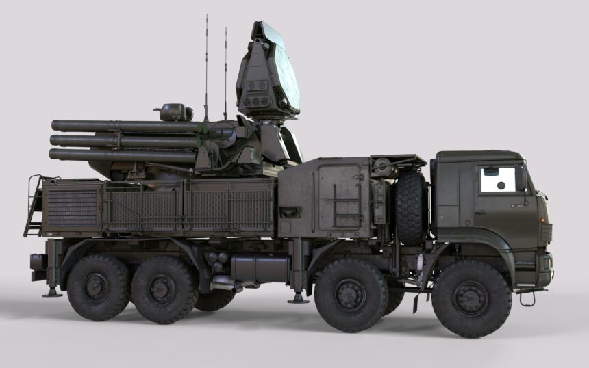
The hum of machinery, the scent of ozone, the stark glow of monitors – these are the hallmarks of a modern operations center where strategic decisions are made, and the instruments of national security are managed. Within this controlled environment, a quiet revolution has been underway for decades, one driven by the invisible tendrils of satellite signals. At the heart of this revolution lies Global Positioning System (GPS) technology, a system that has transcended its civilian origins to become an indispensable tool in the precise guidance of military ordnance, transforming the landscape of modern warfare.
The ability to strike a target with pinpoint accuracy, minimizing collateral damage and maximizing effectiveness, is no longer the stuff of science fiction. GPS has made it a tangible reality, offering a level of control and predictability that was unimaginable even a generation ago. This technology, once a strategic advantage for nations, has now permeated military thinking across the globe, fundamentally altering engagement doctrines, tactical planning, and the very nature of deterrence.
At its core, GPS is a satellite-based radio-navigation system. Developed and maintained by the United States Space Force, it comprises a constellation of over 30 satellites orbiting the Earth. These satellites transmit precise timing signals and their orbital location information. A GPS receiver, whether in a smartphone or a missile guidance system, picks up these signals from multiple satellites. By measuring the time it takes for signals from at least four satellites to arrive, the receiver can calculate its precise three-dimensional position (latitude, longitude, and altitude) and its velocity. This seemingly simple triangulation process, repeated continuously, provides a constant, real-time stream of positional data.
The Satellite Constellation: A Network in Orbit
The operational integrity of the GPS system hinges on its carefully orchestrated network of satellites. Spread across medium Earth orbit (MEO) at an altitude of approximately 20,200 kilometers, these satellites are positioned in a way that ensures at least four are always in view from any point on Earth. This redundancy is crucial, as it allows for accurate positioning even if some satellites are experiencing technical issues or are temporarily obscured. The satellites operate in precise orbits, constantly broadcasting their identity, orbital parameters, and atomic clock time.
The Role of Atomic Clocks: Unwavering Accuracy
The accuracy of GPS relies heavily on the incredibly precise atomic clocks onboard each satellite. These clocks are far more accurate than any terrestrial clock, maintaining a deviation of less than one second in millions of years. This extreme precision is necessary because the travel time of radio signals is measured in nanoseconds. Even a tiny error in timing would translate into significant positional inaccuracies when calculating distances from the satellites. The atomic clocks synchronize the signals, allowing receivers to determine precise distances based on the signal’s arrival time.
Receiver Technology: Decoding the Signals
The GPS receiver, the counterpart to the satellite constellation, is a sophisticated piece of engineering. Its primary function is to capture, process, and interpret the radio signals broadcast by the satellites. This involves antennas to receive the signals, sophisticated digital signal processors to filter out noise and extract the relevant data, and algorithms to perform the complex calculations required for position determination. The accuracy of the receiver itself, including the quality of its antenna and processing capabilities, directly impacts the overall precision of the navigation solution.
The Doppler Effect: A Secondary Source of Information
Beyond simple timing, the Doppler effect also plays a crucial role in enhancing GPS accuracy, particularly for applications involving high speeds or precise velocity calculations. As a satellite moves towards or away from a receiver, the frequency of its transmitted signal is perceived to shift – a phenomenon known as the Doppler effect. By measuring this frequency shift, the receiver can deduce the relative velocity between itself and the satellite, providing complementary data that further refines the position and speed calculations.
The Geometry of Satellites: Dilution of Precision (DOP)
The geometric arrangement of the satellites in the sky relative to the receiver, known as the “Dilution of Precision” (DOP), significantly impacts the accuracy of the calculated position. When the satellites are widely spread across the sky, the receiver can form more precise triangles (or tetrahedrons in 3D), leading to a lower DOP value and higher accuracy. Conversely, if the satellites are clustered together, the geometry is weaker, leading to a higher DOP and reduced accuracy. Military GPS receivers are often designed to prioritize satellite selections that minimize DOP.
GPS technology plays a crucial role in modern military operations, particularly in guiding missiles to their targets with precision. For a deeper understanding of how GPS systems enhance the accuracy and effectiveness of missile guidance, you can read a related article on this topic at In the War Room. This article delves into the intricacies of GPS navigation and its impact on contemporary warfare strategies.
From Civilian Tool to Military Mandate: The Evolution of GPS in Defense
Initially conceived as a Cold War-era project to provide a global navigation capability for the U.S. military, GPS quickly found its way into civilian applications. However, its military utility was always paramount. The ability to guide assets with unprecedented precision dramatically altered operational planning and execution across all branches of the armed forces.
Early Applications: Enhancing Battlefield Awareness
In its nascent stages, GPS was integrated into various military platforms to enhance situational awareness and navigation. Ground troops, naval vessels, and aircraft could all benefit from accurate positioning, reducing reliance on traditional, less precise navigation methods. This improved awareness allowed for more efficient troop movement, better coordination of operations, and faster response times.
Precision Navigation for Ground Forces
For soldiers on the ground, GPS provided a vital lifeline. Navigating complex terrain, especially under adverse weather conditions or enemy fire, became significantly less disorienting. Units could maintain their intended routes, rendezvous at pre-determined locations with greater certainty, and avoid becoming lost, a critical factor in prolonging operational effectiveness and minimizing casualties.
Maritime and Aerial Navigation: Charting New Territories
Naval operations, from submarine navigation to aircraft carrier operations, benefited immensely. Precise positioning allowed for safer navigation in crowded waterways, more accurate deployment of assets, and improved capabilities for search and rescue missions. Similarly, fighter jets and bombers could plot more direct and fuel-efficient routes, and conduct precision aerial reconnaissance with greater confidence.
The Revolution in Munitions: Smart Weapons Come of Age
The true game-changer for GPS in military applications has been its integration into guided munitions, often referred to as “smart weapons.” By equipping bombs, missiles, and even artillery shells with GPS receivers and steerable fins or control surfaces, these projectiles can actively adjust their trajectory mid-flight to home in on a target with remarkable accuracy.
GPS-Guided Bombs: Reducing Collateral Damage
The development of GPS-guided bombs, such as the Joint Direct Attack Munition (JDAM) series, marked a significant leap forward. These unguided bombs are fitted with a kit that includes a GPS receiver, inertial navigation system (INS), and control fins. Once released, the JDAM uses its INS to track its initial trajectory and then corrects its course using GPS data to steer towards a pre-programmed target. This capability drastically reduces the potential for collateral damage by allowing for much tighter weapon impact probabilities, a critical consideration in urban warfare or operations in densely populated areas.
Cruise Missiles: Long-Range Precision Strikes
Cruise missiles, designed for long-range engagements, have also heavily relied on GPS for navigation. These unmanned, self-propelled projectiles fly at low altitudes, often following terrain-following radar to evade detection. GPS provides the primary navigation system, guiding the missile across vast distances to its target with sub-meter accuracy. This significantly enhances their lethality and reduces the risk to friendly forces.
Artillery and Mortars: Expanding the Reach of Indirect Fire
The application of GPS isn’t limited to aerial ordnance. GPS has also been integrated into smart artillery shells and mortar rounds, allowing for highly accurate indirect fire. This enables artillery units to engage targets with the same precision previously only achievable with direct fire, dramatically increasing their tactical flexibility and effectiveness on the battlefield.
Beyond Basic Navigation: Military-Specific Enhancements and Resiliency

While the core principles of GPS remain the same, the military has developed specialized enhancements and strategies to ensure its reliability and effectiveness in challenging operational environments. This includes measures to counter potential threats and improve accuracy under various conditions.
Selective Availability: A Historical Precedent
In the early days of GPS, the U.S. military intentionally degraded the accuracy of the civilian signal through a process called “Selective Availability” (SA). This ensured a significant performance advantage for military users. However, in May 2000, President Bill Clinton ordered the discontinuation of SA, primarily to allow for greater access to GPS for civilian applications and to encourage technological development. While SA is no longer active, the historical precedent underscores the military’s capacity to control the signal’s performance characteristics for its own benefit.
Anti-Spoofing and Anti-Jamming Technologies: Protecting the Signal
In a modern conflict, adversaries may attempt to disrupt GPS signals through jamming (overwhelming the receiver with a stronger, false signal) or spoofing (broadcasting a falsified GPS signal to mislead the receiver). The military has invested heavily in technologies to counter these threats. This includes receivers with advanced signal processing capabilities that can detect and reject jamming signals, as well as sophisticated algorithms that can identify and reject spoofed signals.
Enhanced Receiver Design: Filtering Out Interference
Military-grade GPS receivers are designed with robust hardware and software to withstand electronic warfare. They incorporate advanced filtering techniques to isolate the weak GPS signals from stronger, interfering signals. This allows them to maintain a lock on the legitimate satellites even in environments saturated with electronic noise.
Inertial Navigation System (INS) Integration: A Complementary Backbone
For missions where GPS signal availability is uncertain or intentionally denied, military systems often integrate GPS with Inertial Navigation Systems (INS). An INS uses accelerometers and gyroscopes to track a vehicle’s motion from a known starting point. While INS is prone to drift over time without external updates, when combined with GPS, it creates a powerful hybrid system. GPS provides periodic corrections to the INS, keeping its position estimates accurate, while the INS can bridge temporary GPS outages, ensuring continuous navigation.
Precise Positioning Service (PPS): The Military’s Dedicated Signal
In addition to the Standard Positioning Service (SPS) available to civilian users, GPS provides a more secure and accurate signal known as the Precision Positioning Service (PPS). PPS is encrypted and requires an authorized military receiver to access. This encryption prevents unauthorized users from benefiting from the higher accuracy and ensures that only friendly forces can leverage this enhanced capability.
Encryption and Authentication: Securing the Data Stream
The PPS signal is encrypted using advanced cryptographic techniques. This prevents adversaries from intercepting and deciphering the navigation data. Furthermore, the system incorporates authentication protocols that verify the integrity and origin of the GPS signals, ensuring that receivers are not being fed false information by an enemy.
Integrating GPS into Complex Weapon Systems: The Engineering Challenge

The successful integration of GPS technology into military weapon systems is a testament to sophisticated engineering and meticulous testing. It involves not just the receiver itself but also its seamless interaction with other mission-critical components.
The Missile’s Brain: Guidance, Navigation, and Control (GNC)
At the heart of any guided missile lies its Guidance, Navigation, and Control (GNC) system. GNC is a complex interplay of sensors, processors, and actuators. The GPS receiver provides the “Navigation” component, continuously feeding the GNC system with the missile’s current position and velocity. This data is then processed by the guidance system, which calculates the necessary corrections to steer the missile towards its target. The control system then translates these commands into physical actions by actuating the missile’s control surfaces.
The Guidance Algorithm: Steering Towards the Mark
The guidance algorithm is the intelligence that dictates how the missile will fly. It takes the target coordinates (often programmed before launch or updated in-flight) and the missile’s current state (position, velocity, orientation) and continuously calculates the desired trajectory adjustments. Different guidance algorithms exist, each with its own strengths and weaknesses, but all aim to minimize the miss distance.
The Control Surface Actuation: Finer Adjustments in Flight
Once the guidance algorithm determines the necessary course correction, the control system is responsible for executing it. This involves sending signals to electric or hydraulic actuators that move the missile’s control surfaces – such as fins or canards. The precise and synchronized movement of these surfaces allows the missile to maneuver in the air, precisely following the path dictated by the guidance system.
Environmental Factors: Accounting for Atmospheric and Aerodynamic Effects
The atmospheric conditions and aerodynamic forces encountered by a missile during its flight can significantly affect its trajectory. GPS-guided systems must account for these factors to maintain accuracy. This includes understanding how wind, air density, and the missile’s own speed and shape influence its flight path.
Atmospheric Effects: Wind and Air Density
Wind, especially at higher altitudes, can exert significant force on a missile, pushing it off its intended course. Air density also changes with altitude, affecting the aerodynamic forces acting on the missile. Advanced GNC systems incorporate atmospheric models and real-time sensor data to compensate for these variations, ensuring the missile stays on track.
Aerodynamic Considerations: Stability and Maneuverability
The aerodynamic design of a missile is critical for its stability and maneuverability. While the GNC system guides the missile, its inherent aerodynamic characteristics dictate how effectively it can respond to control inputs. Engineers must balance the need for stability during flight with the ability to execute sharp turns and evasive maneuvers when necessary.
Target Recognition and Terminal Guidance: The Final Approach
While GPS is instrumental in guiding a weapon to the general vicinity of its target, some advanced systems incorporate additional sensors for terminal guidance. This allows for even greater precision in the final moments of flight, especially when targeting moving or elusive objectives.
Infrared and Laser Seekers: Homing in on Heat or Reflections
Many modern missiles employ infrared (IR) seekers, which detect the heat signature of a target, or laser seekers, which lock onto reflected laser energy. These terminal guidance systems can provide an independent means of tracking the target in the final phase of flight, overriding or complementing the GPS guidance. This is particularly useful for engaging targets that might have moved after the initial GPS lock.
Image Recognition: Identifying the Specific Target
The most advanced weapon systems may even incorporate image recognition capabilities. These systems can analyze visual data from onboard cameras, comparing it to pre-programmed target profiles to ensure that the correct objective is being engaged. This adds a layer of discrimination, crucial for complex scenarios where multiple potential targets might be present.
The precision of modern missile systems has significantly improved, largely due to advancements in GPS technology. This sophisticated navigation system allows missiles to be guided with remarkable accuracy, ensuring they reach their intended targets with minimal collateral damage. For a deeper understanding of how GPS plays a crucial role in military operations, you can explore a related article that delves into the intricacies of this technology and its applications in warfare. To read more about it, visit this insightful piece.
The Future of GPS and Precision Warfare: Continuous Innovation
| Aspect | Details |
|---|---|
| Accuracy | GPS technology provides precise guidance for missiles to hit their targets with high accuracy. |
| Speed | GPS enables missiles to navigate at high speeds towards their intended destinations. |
| Reliability | GPS systems offer reliable positioning and navigation data, ensuring the missiles reach their targets effectively. |
| Integration | GPS is integrated with missile guidance systems to provide real-time positioning and course corrections. |
The evolution of GPS technology and its application in military contexts is far from over. Ongoing research and development are focused on further enhancing accuracy, improving resiliency against countermeasures, and integrating GPS with emerging battlefield technologies.
Next-Generation Satellite Systems: More Signals, Greater Accuracy
Future generations of GPS satellites are being designed to transmit more signals and with enhanced accuracy. Efforts are underway to ensure that civilian and military users will have access to even more robust and precise positioning data. This includes the development of new signal structures and the implementation of advanced error correction techniques.
Enhanced Signal Encryption and Authentication: Fortifying the System
Future military GPS signals are expected to feature even more sophisticated encryption and authentication mechanisms. This will make it significantly harder for adversaries to jam or spoof the signals, providing a higher level of assurance for military operations.
Interoperability and Augmentation: Working with Other Systems
There is a growing emphasis on ensuring interoperability between GPS and other global navigation satellite systems (GNSS) like Russia’s GLONASS, Europe’s Galileo, and China’s BeiDou. By leveraging signals from multiple GNSS, future systems can offer greater availability and accuracy, especially in challenging environments. Augmentation systems, such as ground-based or satellite-based augmentation systems (GBAS and SBAS), are also being developed to further enhance precision.
Quantum Navigation: The Ultimate Frontier?
While still in its early stages of research, quantum navigation holds the potential for a paradigm shift in navigation technology. Quantum sensors could offer independent navigation capabilities that are not reliant on external signals, rendering them immune to jamming and spoofing. This could represent the next frontier in achieving absolute navigational precision, offering true autonomy for military assets.
Quantum Accelerometers and Gyroscopes: Inertial Navigation Reimagined
Quantum mechanics offers the possibility of developing accelerometers and gyroscopes with unprecedented sensitivity. These quantum inertial sensors could provide highly accurate and stable navigation data for extended periods, far surpassing current INS capabilities and potentially reducing the reliance on satellite-based systems altogether.
Integrated Battlefield Awareness: A Connected Future
The future of precision warfare will undoubtedly involve a deeper integration of GPS data with other battlefield information sources. This will create a more comprehensive and dynamic understanding of the operational environment, enabling even more informed and precise decision-making.
Swarming Technologies and Autonomous Systems: Coordinated Precision
As autonomous systems and drone swarms become more prevalent, precise GPS navigation will be essential for their coordination and effectiveness. GPS will enable these systems to operate in concert, executing complex missions with unparalleled precision and adaptability.
Cyber Resilience: Protecting the Data Flow
With the increasing reliance on networked systems, the cyber resilience of GPS data flow is paramount. Protecting GPS receivers and the data they transmit from cyber threats will be a critical area of focus, ensuring the integrity and trustworthiness of the navigation information in an interconnected battlespace.
In conclusion, GPS technology has evolved from a revolutionary concept into a fundamental pillar of modern military strategy. Its ability to guide munitions with unparalleled precision has reshaped the battlefield, offering enhanced effectiveness, reduced risk, and a new paradigm for deterrence. As the technology continues to advance, its role in shaping the future of warfare will only become more pronounced, promising even greater accuracy, resilience, and interconnectedness in the pursuit of strategic objectives. The quiet hum of global positioning satellites, unseen and often unacknowledged, continues to orchestrate a symphony of precision, guiding the instruments of power with an accuracy that defines the cutting edge of defense.

The Hidden Weakness Behind Modern Warfare
FAQs
What is GPS?
GPS stands for Global Positioning System, which is a network of satellites that orbit the Earth and provide location and time information to GPS receivers.
How does GPS guide missiles?
Missiles use GPS to determine their current location and the location of their target. By receiving signals from multiple satellites, the missile’s onboard computer can calculate its precise position and make adjustments to its trajectory to reach the target.
Why is GPS important for guiding missiles?
GPS provides accurate and reliable positioning information, allowing missiles to navigate over long distances and hit their targets with precision. This is crucial for military operations and minimizing collateral damage.
Can GPS be jammed to prevent missiles from reaching their targets?
Yes, GPS signals can be jammed or spoofed to disrupt the guidance of missiles. This is a concern for military forces, and countermeasures are developed to protect against GPS interference.
Are there alternative guidance systems for missiles besides GPS?
Yes, there are alternative guidance systems such as inertial navigation, terrain contour matching, and celestial navigation. These systems can be used in combination with GPS or as standalone options for missile guidance.