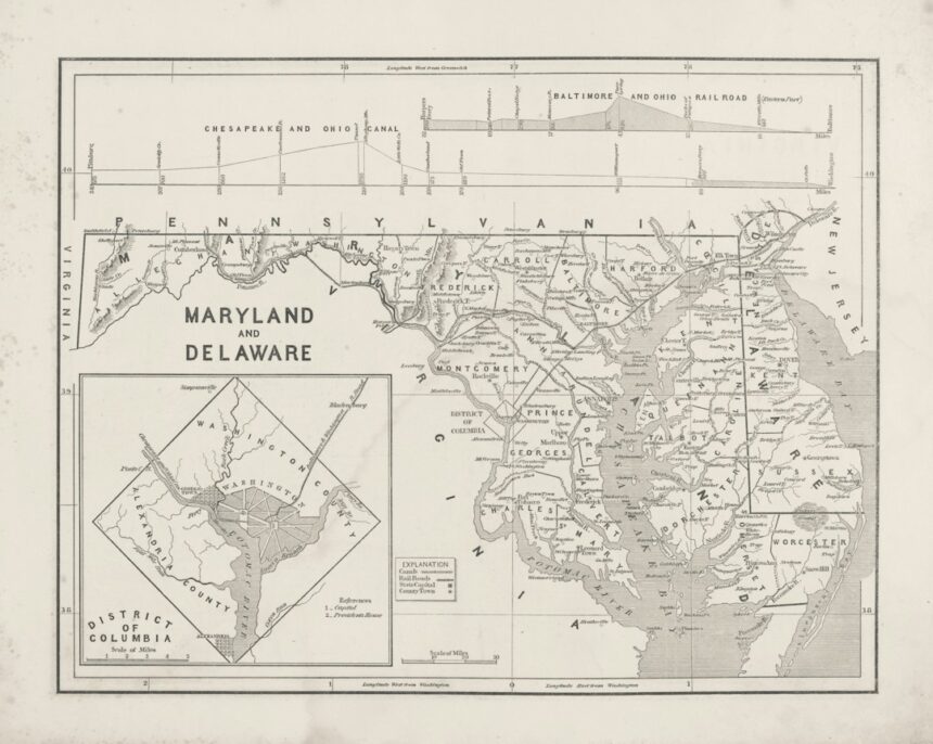
The Smithsonian Army Map Service, an often-unsung repository of cartographic history, holds within its archives a treasure trove of information not just about geographical representations, but about the very evolution of military strategy, technological advancement, and societal understanding of the world. The sheer volume and historical depth of its holdings offer unparalleled insights into how maps have been created, utilized, and interpreted over centuries, with a particular focus on their indispensable role in military operations. Tracing the legacy of the Army Map Service (AMS) through its cartographic output reveals a fascinating narrative of information gathering, dissemination, and the strategic imperatives that drove map production. From its origins as a rudimentary mapping unit to its sophisticated operations during global conflicts, the AMS has been a critical nexus for cartographic knowledge.
The Genesis and Evolution of the Army Map Service
The origins of the Army Map Service can be traced back to the nascent days of the United States Army’s need for accurate geographical information. Early mapping efforts were often ad hoc, relying on surveys conducted by explorers, engineers, and military expeditions. The formal establishment of a dedicated mapping organization within the Army, however, gained momentum as the nation’s territorial expansion and increasing involvement in international affairs underscored the strategic importance of cartography. The AMS, in its various guises and under different organizational structures, consistently served the dual purpose of supporting domestic infrastructure development and, crucially, providing the intelligence necessary for military campaigns. Its evolution mirrored the technological advancements of the era, from hand-drawn charts to the sophisticated photogrammetric techniques and satellite imagery that define modern cartography. The sheer scale of its operations expanded exponentially with the onset of major conflicts, transforming it from a relatively small unit into a vast enterprise dedicated to the rapid production and distribution of maps on a global scale.
Early Military Cartographic Needs
In its formative years, the U.S. Army’s cartographic requirements were primarily driven by westward expansion and the exploration of newly acquired territories. Expeditionary forces, such as those led by Lewis and Clark, relied on rudimentary mapping to chart routes, identify resources, and understand the terrain. The Mexican-American War further highlighted the need for detailed maps of foreign territories, pushing the boundaries of what cartographic capabilities were available. These early maps, often created by individual officers with limited resources and varying degrees of cartographic skill, nonetheless laid the groundwork for more systematic approaches to military mapping. The challenges of surveying vast and often unmapped regions, coupled with the practicalities of military logistics and troop movements, instilled a deep understanding of the critical link between accurate geographical representation and operational success.
The Impact of World Wars on Map Production
The two World Wars represented pivotal moments in the history of the Army Map Service and military cartography in general. The sheer scale of global conflict demanded an unprecedented surge in map production. The AMS, and its predecessors, were tasked with creating maps of far-flung theaters of operation, often in regions where detailed cartographic data was scarce or non-existent. This led to the development of innovative techniques for rapid map compilation, including the extensive use of aerial photography and photogrammetry. The need for accurate intelligence on enemy positions, troop movements, and terrain features became paramount, driving a continuous cycle of data acquisition, processing, and map dissemination. The global nature of these conflicts also necessitated international cooperation, as Allied nations shared cartographic resources and expertise to achieve common military objectives. The technological advancements spurred by these wartime demands, from improved printing techniques to the early development of aerial reconnaissance, had a lasting impact on the field of cartography.
Post-War Consolidation and Modernization
Following the conclusion of World War II, the Army Map Service underwent periods of consolidation and modernization. The lessons learned during the war were incorporated into new doctrines and organizational structures. Emphasis was placed on standardization, efficiency, and the integration of emerging technologies. The Cold War era, with its global strategic implications, continued to drive significant investment in cartographic capabilities. The development of sophisticated survey techniques, advancements in printing technology, and the early exploration of aerial and eventually satellite imagery collection capabilities all contributed to the AMS’s evolving role. This period saw a shift towards a more systematic and comprehensive approach to mapping, encompassing not only military targets but also critical infrastructure and resources in potential conflict zones worldwide.
The Smithsonian Army Map Service has played a crucial role in the development and distribution of military cartography, providing essential resources for both historical research and contemporary applications. For a deeper understanding of the significance of military maps and their impact on warfare, you can explore a related article that discusses the evolution of military mapping techniques and their importance in strategic planning. To read more, visit this article.
The Cartographic Arsenal: Types of Maps and Their Significance
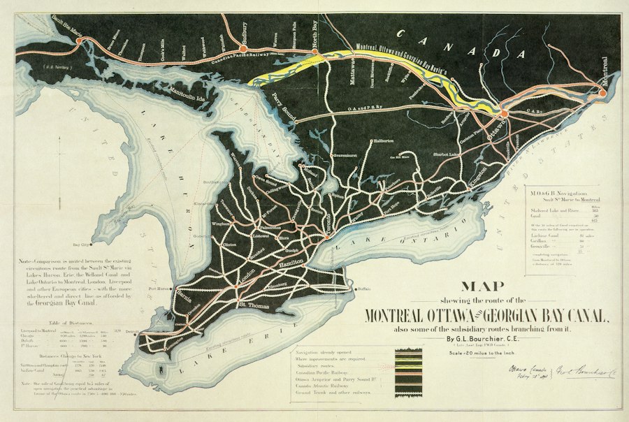
The Army Map Service’s archives encompass an extraordinary diversity of map types, each serving a distinct purpose within the military’s operational framework. These maps are not merely static representations of geography; they are dynamic tools that inform strategic planning, guide tactical execution, and provide critical situational awareness. From the broad strokes of strategic overview maps to the minute details of tactical situation maps, each category offers unique insights into the way military forces perceived and interacted with the physical world. The AMS’s collection reflects a deep understanding of the varied needs of military personnel at all levels, from the highest command echelons down to individual units operating in the field.
Strategic Overview Maps
Strategic overview maps, often covering vast geographical areas, were essential for long-term planning and the assessment of broad geopolitical landscapes. These maps typically focused on major geographical features, political boundaries, transportation networks, and the distribution of key resources. They allowed military leaders to visualize potential theaters of operation, understand the logistical challenges of deploying forces, and identify strategic objectives. The creation of these maps required the synthesis of a wide range of data, often gathered from diverse sources, and their accuracy was paramount for informed decision-making at the highest levels of command. The evolution of strategic mapping reflects changes in global power dynamics and the increasing complexity of international relations.
The Smithsonian Army Map Service has played a crucial role in the development of cartographic resources for military and civilian use, and its historical significance is explored in depth in a related article. For those interested in understanding the evolution of military mapping and its impact on strategy, you can read more about it in this insightful piece on In the War Room. This article delves into the technological advancements and methodologies that have shaped modern mapping practices, highlighting the enduring legacy of the Army Map Service.
Tactical Situation Maps
In contrast to their broader counterparts, tactical situation maps provided detailed, real-time or near-real-time representations of the immediate operational environment. These maps were indispensable for ground commanders and unit leaders, depicting the positions of friendly and enemy forces, terrain features, obstacles, and lines of communication. The creation and updating of tactical maps were often a race against time, requiring rapid compilation from reconnaissance reports, aerial imagery, and ground observations. The accuracy and detail of these maps directly impacted battlefield decisions, influencing troop movements, fire support coordination, and the overall execution of combat operations. The development of standardized symbology and conventions for tactical maps was crucial for ensuring clear and unambiguous communication among different units.
Specialized Thematic Maps
Beyond general-purpose maps, the Army Map Service also produced a wide array of specialized thematic maps tailored to specific military requirements. These could include maps detailing population densities for civil affairs operations, resource inventories for logistical planning, geological surveys for engineering purposes, or even maps illustrating anticipated weather patterns. The creation of these thematic maps often involved the overlaying of various data sets onto a base map, allowing for complex analyses and the identification of critical relationships between different geographical and thematic elements. This approach allowed military planners to go beyond mere geographical representation and to understand the multidimensional aspects of an operational environment.
Topographic Maps and Their Importance
Topographic maps, characterized by their detailed depiction of elevation and landforms through contour lines, were a cornerstone of military cartography. Understanding the topography of a region was fundamental for planning military movements, identifying defensive positions, and assessing the effectiveness of artillery fire. The AMS was a prolific producer of topographic maps, often at highly detailed scales, covering both domestic and foreign territories. The accuracy of these maps was a testament to the skills of surveyors and draftsmen, as well as the advancements in surveying technology. The ability to accurately represent the three-dimensional nature of the terrain in a two-dimensional format was a crucial skill that enabled military forces to operate effectively in diverse landscapes.
Cartographic Technologies and Methodologies
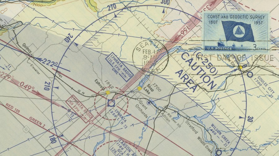
The Army Map Service’s enduring legacy is inextricably linked to its pioneering and adoption of evolving cartographic technologies and methodologies. From the painstaking precision of hand-drawn maps to the complex algorithms of digital cartography, the AMS consistently sought to harness the most effective tools available to create accurate and useful geographical representations. This continuous adaptation and innovation underscore the dynamic nature of cartography as a field, driven by both scientific progress and the practical demands of its users. The archive serves as a tangible record of these technological shifts, offering a unique perspective on the history of mapping in the modern era.
The Art of Hand-Drawn Cartography
In the early days of the Army Map Service, the creation of maps was a meticulous and labor-intensive process, relying on the skill and artistry of cartographers. Hand-drawn maps demanded a profound understanding of surveying principles, projection systems, and the conventions of cartographic representation. Draftsmen would painstakingly transcribe data from field surveys, aerial photographs, and existing maps onto large sheets of paper or vellum. The accuracy of these maps depended on the precision of their drafting tools, the quality of their inks, and the artistic skill of the cartographer in rendering features like contour lines, vegetation, and human settlements. Despite the advent of more advanced technologies, hand-drawn maps continued to be produced for specific purposes due to their clarity, aesthetic appeal, and the unique human touch that could convey subtle nuances of the terrain.
The Revolution of Photogrammetry and Aerial Photography
The widespread adoption of aerial photography and photogrammetry marked a profound turning point in the history of military mapping. The ability to capture images of the Earth’s surface from aircraft allowed for the rapid acquisition of vast amounts of geographical data, significantly accelerating the map production process. Photogrammetry, the science of making measurements from photographs, enabled cartographers to extract accurate elevation data, planimetric features, and other topographical information from aerial images. This technology was particularly crucial during wartime, allowing for the creation of maps of rapidly changing front lines and newly occupied territories with unprecedented speed and detail. The AMS became a leading institution in developing and applying photogrammetric techniques, transforming its capacity to support military operations.
The Dawn of Digital Cartography
The latter half of the 20th century witnessed the emergence of digital cartography, a paradigm shift that revolutionized mapmaking and geospatial information management. The development of computers and sophisticated software allowed for the creation, manipulation, and analysis of maps in a digital format. This transition from analog to digital opened up new possibilities for data integration, dynamic mapping, and the creation of interactive geospatial databases. The Army Map Service was at the forefront of adopting these digital technologies, investing in the infrastructure and expertise needed to manage and utilize digital map data. This move towards digital mapping not only increased efficiency but also enabled more complex spatial analyses and facilitated the seamless integration of geographic information with other military systems.
Standardization and Quality Control in Map Production
Throughout its history, the Army Map Service placed a significant emphasis on standardization and rigorous quality control in map production. This commitment was essential to ensure the accuracy, consistency, and interoperability of maps used by diverse military units operating in various theaters. Standardized symbols, projection systems, and data formats were developed and meticulously adhered to. Quality control processes, including multiple layers of review and verification, were implemented at every stage of map production, from data collection to final printing. This dedication to precision and reliability cemented the reputation of AMS maps as trusted tools for military decision-making, even in the most demanding operational environments.
Legacy and Modern Relevance of the Smithsonian’s Collection
The vast collection of maps housed within the Smithsonian, largely originating from the Army Map Service, represents more than just historical artifacts; it is a living testament to the evolution of our understanding of the world and the critical role cartography has played in shaping human endeavors, particularly in the military sphere. The insights gleaned from these maps extend far beyond their geographical content, offering a unique window into historical events, technological advancements, and the very nature of strategic thinking. The continued accessibility and study of these archives by researchers, historians, and cartographers ensure that the legacy of the Army Map Service remains relevant for understanding both the past and the present.
Unlocking Historical Narratives
The maps preserved by the Smithsonian’s Army Map Service collections are invaluable for reconstructing historical narratives. By examining the cartographic products of different eras, historians can gain a deeper understanding of military campaigns, territorial disputes, exploration efforts, and the shifting geopolitical landscapes of past centuries. The detail and accuracy of these maps can reveal strategic intentions, logistical challenges, and the perceived importance of different geographical areas at specific points in time. For instance, the maps produced during World War II offer a granular view of troop movements, front lines, and the strategic importance of various terrains, providing essential context for understanding the conduct and outcomes of battles.
Insights into Military Strategy and Operations
The Army Map Service’s cartographic output provides a rich source of data for understanding the evolution of military strategy and operational planning. The types of maps produced, their scales, and the information they prioritize offer clues about the prevailing military doctrines and technological capabilities of different periods. For example, the transition from hand-drawn maps to photogrammetric products reflects a shift towards more rapid intelligence gathering and battlefield awareness. Studying the thematic maps developed for specific operations can illuminate the complex interplay between geography, resources, and military objectives. This collection allows for a detailed analysis of how military forces have leveraged cartographic information to achieve their aims throughout history.
The Role of Cartography in Technological Advancement
The evolution of cartographic technologies and methodologies, as documented by the Army Map Service’s holdings, is a story of continuous innovation. The transition from manual drafting to aerial photography, photogrammetry, and eventually digital mapping highlights the symbiotic relationship between cartography and technological progress. Each advancement in surveying, imaging, or computing power directly impacted the quality, speed, and scope of map production. The Smithsonian’s collection serves as a tangible archive of these advancements, demonstrating how military needs have often been a powerful catalyst for pushing the boundaries of cartographic science and technology.
Preserving a Global Geographic Heritage
The Army Map Service’s collection at the Smithsonian is a vital repository of global geographic heritage. Many of the maps within its archives document regions and features that may have changed significantly over time, offering a unique historical record of the Earth’s surface. This heritage is not only of interest to military historians but also to geographers, environmental scientists, urban planners, and anyone interested in the long-term evolution of human settlements and landscapes. The preservation of these maps ensures that future generations can access and study this invaluable historical and geographical record, fostering a deeper appreciation for the interconnectedness of human activities and the physical environment.
Contemporary Applications and Future Research
While rooted in history, the maps and methodologies associated with the Army Map Service continue to hold contemporary relevance and offer fertile ground for future research. The principles of accurate surveying, data integration, and spatial analysis that underpinned the AMS’s work are fundamental to modern geographic information systems (GIS) and geospatial intelligence. Researchers can draw upon the historical data and cartographic techniques to inform current geospatial analyses, develop historical GIS projects, and explore long-term environmental changes. Furthermore, the study of past mapping strategies can offer valuable lessons for contemporary military planning and disaster response, highlighting the enduring importance of robust cartographic capabilities in an increasingly complex world. The ongoing efforts to digitize and make accessible these collections promise to unlock even more potential for new discoveries and applications.

The 1958 Space Nukes Meant to Destroy Soviet Missiles
FAQs
What is the Smithsonian Army Map Service Tracking system?
The Smithsonian Army Map Service Tracking system is a tool used by the Smithsonian Institution to keep track of the location and movement of their collection of maps and other cartographic materials.
How does the Smithsonian Army Map Service Tracking system work?
The system uses a combination of barcoding, RFID technology, and a centralized database to monitor the whereabouts of each map in the collection. Each map is assigned a unique identifier that is scanned or read by RFID readers at various checkpoints.
Why is it important for the Smithsonian to track their maps using this system?
Tracking the maps using the Smithsonian Army Map Service Tracking system helps the institution maintain an accurate inventory of their collection, prevent loss or theft of valuable materials, and streamline the process of locating specific maps for research or exhibition purposes.
Can researchers or visitors access the tracking information for specific maps in the Smithsonian’s collection?
While the tracking information for specific maps may not be directly accessible to researchers or visitors, the system allows the Smithsonian staff to quickly locate and retrieve requested maps, making the research process more efficient and convenient for users.
Is the Smithsonian Army Map Service Tracking system used only for maps, or can it be applied to other types of collections?
While the system was initially designed for tracking maps, the technology and methodology can be adapted for tracking other types of collections within the Smithsonian Institution, such as artwork, artifacts, or documents, to ensure their proper management and preservation.