Mastering Military Navigation Without GPS
In the intricate dance of modern warfare, the ability to navigate with precision is paramount. While global positioning systems (GPS) have become an indispensable tool, their susceptibility to jamming, spoofing, or outright failure in contested environments necessitates a robust proficiency in traditional navigation techniques. Military personnel, therefore, must cultivate a deep understanding of methodologies that predate satellite technology, ensuring operational effectiveness regardless of electronic warfare capabilities or environmental limitations. This article delves into the essential skills and knowledge required to master military navigation without relying on GPS, exploring the foundational principles and practical applications that allow soldiers to orient themselves and move with purpose through any terrain or circumstance.
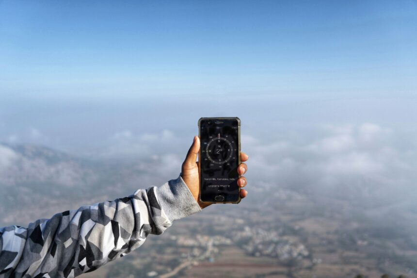
The magnetic compass, a deceptively simple instrument, remains the cornerstone of non-GPS navigation for military personnel. Its reliability, independence from external electronic signals, and fundamental reliance on Earth’s magnetic field make it an unshakeable ally in any operational theatre. Understanding its nuances and mastering its application is not merely about pointing it in a direction; it involves a comprehensive grasp of its mechanics, potential inaccuracies, and how to mitigate them.
Understanding the Compass Mechanism
At its core, a magnetic compass contains a magnetized needle that aligns itself with the Earth’s magnetic field. This needle is typically housed within a liquid-filled capsule to dampen oscillations and provide a stable reading. The capsule is mounted on a pivot, allowing the needle to rotate freely. The compass housing usually includes a baseplate with a protractor scale for plotting bearings, a direction-of-travel arrow, and a rotating bezel marked with degrees.
Recognizing and Compensating for Magnetic Declination
One of the most critical aspects of accurate compass navigation is understanding magnetic declination. The Earth’s magnetic poles are not perfectly aligned with its geographic poles. Magnetic declination is the angular difference between true north (geographic north) and magnetic north at any given location. This difference varies geographically and over time, and ignoring it can lead to significant positional errors, especially over long distances.
Military maps, vital for any navigation endeavor, will typically show the magnetic declination for the area depicted. Navigators must learn to read this declination value and apply it correctly, either by adjusted bearing calculations for moving from a grid bearing to a magnetic bearing, or vice versa. For example, if a map indicates an eastward declination of 10 degrees, and the navigator needs to travel on a true bearing of 90 degrees, they must set their compass to 80 degrees magnetic to follow the desired true path. Conversely, if they are taking a bearing from a physical landmark to its magnetic bearing on the map, they would add the eastward declination. Conversely, for westward declination, the additive and subtractive operations are reversed. This seemingly minor adjustment is the difference between precise movement and being dangerously off course.
Dealing with Local Magnetic Interference
Beyond global declination, local magnetic interference can significantly skew compass readings. Ferrous metals, such as steel structures, vehicles, or even certain types of rocks (iron ore), can create their own magnetic fields that distort the Earth’s natural field. This phenomenon is known as “local attraction.”
Military navigators are trained to be acutely aware of potential sources of local attraction. They will learn to take compass readings away from obvious metallic objects and to perform “swing tests” or “back bearings” from a known point. If a significant difference is observed between a forward bearing and a back bearing to the same point, it often indicates local attraction. In such scenarios, the navigator might need to move to a new position to take a reliable reading or use an average of readings taken from slightly different positions. The ability to recognize and account for these localized anomalies is a hallmark of seasoned navigators.
Advanced Compass Techniques: Orienting the Map and Taking Bearings
The compass is not just for determining direction; it is an essential tool for orienting a map to the terrain. To do this, the navigator places the compass on the map and rotates the map and compass together until the compass needle aligns with the north arrow on the map, while also accounting for magnetic declination. This ensures that the map’s features are aligned with the real-world landscape, allowing for accurate identification of locations and planning of routes.
Taking a bearing to a visible landmark is another fundamental skill. The navigator points the direction-of-travel arrow on the compass towards the landmark, then rotates the bezel until the magnetic needle is aligned within the orienting arrow. The degree reading at the index line on the bezel then represents the magnetic bearing to the landmark. This bearing can then be transferred to the map to pinpoint the navigator’s location (triangulation) or used to plot a course. Conversely, to navigate a specific bearing, the navigator aligns the desired degree on the bezel with the index line, then turns their body and the compass until the magnetic needle is within the orienting arrow. The direction-of-travel arrow then indicates the direction of march.
In the realm of military navigation, the reliance on GPS technology has become increasingly prevalent; however, understanding traditional navigation methods remains crucial. An insightful article that delves into these techniques can be found at this link, where it explores various strategies and tools used by military personnel to navigate effectively without the aid of modern satellite systems. This knowledge not only enhances operational effectiveness but also ensures that troops can maintain their bearings in environments where GPS signals may be compromised.
Map Reading: The Foundation of Situational Awareness
A map is more than just a piece of paper; it is a graphical representation of the Earth’s surface, encoded with vital information for navigation and tactical planning. Mastering map reading is an indispensable skill that allows military personnel to understand their surroundings, identify potential hazards and assets, and plan efficient and safe routes. Without this skill, even the most accurate compass becomes a less effective tool.
Understanding Topographic Maps and Their Features
Military operations predominantly utilize topographic maps, which depict not only man-made features like roads, buildings, and boundaries but also natural features such as elevation, terrain contours, bodies of water, and vegetation. Key elements of a topographic map include contour lines, which connect points of equal elevation, and index contours, which are thicker and labeled with their elevation. The spacing between contour lines indicates the steepness of the terrain: closely spaced lines signify steep slopes, while widely spaced lines denote gentle slopes.
Other important features include symbols representing different types of terrain, vegetation (forests, swamps), and water sources. A legend or key, typically located in the margin of the map, provides explanations for all symbols used. Understanding these symbols is crucial for interpreting the terrain and making informed decisions about movement and concealment.
Declination and Grid Systems on Maps
As mentioned previously, maps crucially display magnetic declination. They also incorporate grid systems, such as the Universal Transverse Mercator (UTM) or Military Grid Reference System (MGRS). These grids provide a standardized method for precisely locating any point on the map, and by extension, in the real world.
The MGRS, for instance, uses a hierarchical system of grids and reference points. Grid zones are designated by letters, followed by 100,000-meter squares, and then individual grid squares measured in meters. Navigators learn to read and plot coordinates accurately using these systems, allowing for precise communication of locations and the ability to navigate to specific waypoints without continuous visual reference. The ability to convert between grid north and magnetic north, accounting for declination, is absolutely fundamental for effective navigation and operations.
Profiling Terrain and Identifying Travel Routes
Effective map reading goes beyond simply identifying features; it involves the ability to visualize the three-dimensional terrain on a two-dimensional surface. By studying contour lines, navigators can mentally construct a terrain profile, understanding the ridges, valleys, and slopes they will encounter. This allows for proactive planning of routes that minimize exposure, conserve energy, and avoid impassable obstacles.
The process of selecting a travel route involves considering several factors: the distance to the objective, the terrain’s difficulty, potential enemy observation points, and the availability of cover and concealment. Navigators will often identify key terrain features, such as hilltops for observation or saddles for easier passage, and plan their route connecting these points. They also consider avenues of approach and withdrawal. This analytical approach to route selection is a critical component of tactical maneuver.
Orienteering: Land Navigation Without a Compass
While a compass is essential, skilled military personnel can also perform basic orienteering without one, relying solely on map reading and an understanding of the terrain. This involves identifying prominent terrain features on the map and then locating them in the real world. By mentally aligning the map with the surroundings, a navigator can determine their approximate position. This is particularly useful when a compass is lost or malfunctioning, or in areas where magnetic interference is extreme. The ability to “dead reckon” or estimate position based on distance traveled and direction assumed is also a critical skill.
Terrain Association and Dead Reckoning: Estimating Your Position

When electronic aids are unavailable and terrain features are sparse, military navigators must rely on the fundamental principles of terrain association and dead reckoning to maintain an awareness of their position. These techniques, while requiring practice and a keen eye, can be remarkably effective in guiding movements through any environment.
Terrain Association: Reading the Landscape
Terrain association is the process of relating the features on a map to their corresponding features in the real world. It’s about actively observing the landscape and using it for navigation. This involves constantly comparing what is seen – a distinct hill, a bend in a river, a cluster of buildings – with the symbols and lines on the map.
The process begins by identifying prominent, easily recognizable features on the map, such as peaks, stream junctions, or distinct man-made structures. Once these are located on the map and identified in the surroundings, the navigator can orient themselves. By observing the relative positions of these features, and noting the direction of travel, they can infer their current location. This requires a constant scan of the environment and an ability to mentally superimpose the map onto the terrain. It’s a dynamic process, as features are identified, confirmed, and then used to navigate to the next identifiable landmark.
Dead Reckoning: Tracking Your Movement
Dead reckoning is a method of navigation that involves calculating one’s current position based on a previously determined position, or a known starting point, and then accounting for the speed, direction, and time of travel. Essentially, it’s keeping a running tally of how far and in what direction you’ve moved.
The process begins with a known position. From there, the navigator estimates their course and distance traveled. This requires a reasonably accurate compass to maintain direction and a way to estimate distance. While in GPS-equipped units, distance might be automatically calculated, in a non-GPS environment, this often relies on pacing (counting steps) or using a watch to estimate distance based on speed. For example, if a soldier knows they can march at 4 kilometers per hour and they travel for 30 minutes on a bearing of 090 degrees, they would have traveled approximately 2 kilometers east of their last known position.
Critical to dead reckoning is the accumulation of errors. Small inaccuracies in direction or distance estimation, when compounded over time, can lead to significant deviations from the intended path. Therefore, skilled navigators using dead reckoning will frequently try to cross-reference their estimated position with terrain features to correct their course. The more frequently these cross-checks can be made, the more accurate the dead reckoning becomes.
Pacing and Estimating Distance
Accurate distance estimation is a cornerstone of dead reckoning. Pacing, the act of counting one’s steps, is the most common method for short distances. Most individuals have a consistent stride length, and by practicing and knowing their own pace count (number of steps per 100 meters), they can estimate distance traveled with reasonable accuracy. Soldiers are often trained to march in formation, which can help maintain a consistent pace.
For longer distances, speed estimation becomes more important. This can be done by estimating average speed over varied terrain, or by using a watch to time movements between known points. In dense vegetation or featureless terrain, pacing and speed estimation can be challenging, requiring a disciplined approach and constant self-correction.
Combining Terrain Association and Dead Reckoning
The real power of non-GPS navigation lies in the synergistic application of terrain association and dead reckoning. While dead reckoning provides a continuous estimate of position, terrain association offers periodic checkpoints and corrections.
A navigator might use dead reckoning to move between two known points, estimating their path and duration. Upon reaching an area with distinct terrain features, they will then use terrain association to confirm their position and correct any accumulated errors from the dead reckoning. This iterative process of estimating and then confirming is what allows for sustained accuracy in navigation. It’s a dance between calculated movement and observational confirmation, ensuring that the navigator stays on track even in challenging conditions.
Celestial Navigation: Harnessing the Stars and Sun
Long before the advent of electronic devices, humanity navigated the globe by observing the celestial bodies. This ancient art, known as celestial navigation, remains a viable and critical skill for military personnel when all other navigation methods are compromised. It offers a direct link to the fundamental principles of Earth’s rotation and position in space.
Understanding the Basics of Celestial Navigation
Celestial navigation relies on observing the position of celestial bodies – primarily the sun during the day and stars at night – relative to the horizon. By measuring the angle of elevation of these bodies above the horizon (altitude) and knowing their precise time, navigators can calculate their position on Earth. This involves understanding concepts like sidereal time, declination of celestial bodies, and the calculation of a “line of position.”
Using the Sun for Navigation (Daytime)
The sun’s path across the sky is predictable and provides two key navigational pieces of information: direction and approximate position. At local apparent noon (when the sun reaches its highest point in the sky), the sun will be due south in the Northern Hemisphere and due north in the Southern Hemisphere (with exceptions at very high latitudes). This provides a quick bearing check.
More sophisticated methods involve using a sextant or similar instrument to measure the sun’s altitude at a specific time. Combined with astronomical data tables (like the Nautical Almanac or Air Almanac) and an estimated position, the navigator can calculate a line of position on which they are located. Taking two such lines of position at different times or of different celestial bodies allows for a fix – a more precise determination of location.
Navigating by the Stars (Nighttime)
Stars offer a wealth of navigational information after sunset. Familiar constellations and prominent stars, such as Polaris (the North Star), are crucial reference points. Polaris, due to its apparent alignment with the Earth’s rotational axis, appears to remain fixed in the sky, making it an excellent indicator of true north. Its altitude above the horizon directly corresponds to the observer’s latitude.
Similar to solar navigation, star sightings with a sextant can be used to derive lines of position. The challenge with celestial navigation, especially in a military context, is the need for clear skies and a period of relative stillness to take accurate readings. Furthermore, the calculations involved can be complex and require meticulous attention to detail and the use of specialized tables. Despite these challenges, the ability to navigate by the stars provides an unparalleled backup in situations where all electronic navigation is rendered useless.
The Importance of Timekeeping in Celestial Navigation
Accurate timekeeping is absolutely critical in celestial navigation. The Earth rotates, and the positions of celestial bodies change with time. Therefore, to accurately calculate one’s position, a precise chronometer is essential. Even a slight error in time can lead to significant positional errors. Military personnel involved in celestial navigation are drilled in maintaining and using accurate timekeeping devices, often with redundant systems to ensure reliability.
In the realm of military navigation, reliance on GPS technology has become commonplace, yet there are still significant discussions surrounding traditional methods. For those interested in exploring alternative navigation techniques, a compelling article can be found that delves into the intricacies of navigating without GPS. This piece highlights the importance of skills such as map reading and celestial navigation, which remain crucial in scenarios where electronic systems may fail. To read more about these essential skills, check out this insightful article on military navigation at In the War Room.
Emergency Navigation and Contingency Planning
| Metrics | Data |
|---|---|
| Compass Accuracy | ±2 degrees |
| Map Reading Skills | Proficient |
| Distance Estimation | Accurate within 10% |
| Landmark Identification | Highly skilled |
| Timekeeping | Precise |
The cornerstone of effective military navigation, especially in the absence of GPS, is robust emergency navigation and contingency planning. This involves anticipating potential failures, developing backup strategies, and ensuring that personnel are trained and equipped to adapt to unforeseen circumstances.
Redundancy in Navigation Equipment
A fundamental principle of military operations is redundancy. This applies directly to navigation equipment. While the primary navigation system might be GPS, secondary and tertiary systems must be available. This includes multiple magnetic compasses, reliable maps of the operational area stored in waterproof cases, and often, a protractor for plotting bearings. Spare batteries for any electronic compasses or GPS units that might still be partially functional should also be part of the standard loadout.
Developing Contingency Plans for GPS Denial
Military units must develop detailed contingency plans for scenarios involving GPS denial. These plans typically outline the procedures for switching to alternative navigation methods, the responsibilities of key personnel, and the communication protocols to be followed. This might involve pre-mission planning to identify key terrain features and alternative routes that can be used if GPS becomes unavailable. Training exercises must regularly incorporate simulated GPS denial to ensure that personnel can execute these plans effectively under pressure.
Maintaining Skills Through Regular Training
The proficiency required for non-GPS navigation is perishable. It demands consistent practice and re-familiarization. Therefore, regular navigation training exercises are essential. These exercises should simulate a variety of conditions, including challenging weather, dense terrain, and limited visibility. They should also test personnel’s ability to operate independently and in small teams when communication systems might also be degraded. This continuous skill refinement ensures that when faced with a genuine GPS failure, military personnel are not operating with rusty or undeveloped skills, but with practiced expertise.
The Human Element: Decision-Making and Situational Awareness Under Pressure
Ultimately, mastering military navigation without GPS hinges on the human element: the decision-making capabilities and situational awareness of the individual navigator. Faced with uncertainty and potential danger, the ability to remain calm, analyze the available information, and make sound judgments is paramount. This involves not only technical proficiency but also mental fortitude and the confidence to trust one’s training and instincts. The best navigation plan is only as good as the individual executing it, and in the absence of electronic guidance, the trained mind becomes the most critical navigational tool.

The Hidden Weakness Behind Modern Warfare
FAQs
What is military navigation without GPS?
Military navigation without GPS refers to the use of alternative methods and technologies for determining location, direction, and route planning in the absence of GPS signals. This can include techniques such as celestial navigation, dead reckoning, and terrain association.
Why is military navigation without GPS important?
Military navigation without GPS is important because GPS signals can be jammed, spoofed, or degraded in certain operational environments. By having alternative navigation methods, military personnel can maintain their ability to navigate effectively and safely in challenging situations.
What are some alternative methods for military navigation without GPS?
Some alternative methods for military navigation without GPS include celestial navigation using stars and planets, dead reckoning using speed, time, and direction, terrain association using landmarks and topographical features, and inertial navigation systems.
How do military personnel train for navigation without GPS?
Military personnel are trained for navigation without GPS through specialized courses and training exercises that focus on teaching the use of alternative navigation methods, map reading, terrain analysis, and the use of navigation tools such as compasses and sextants.
What are the challenges of military navigation without GPS?
Challenges of military navigation without GPS include the need for specialized training, the reliance on environmental conditions and celestial bodies, the potential for human error in calculations, and the limitations of alternative navigation methods in certain operational environments.