“Espionage in the Abyss: Uncovering Secrets at 16,000 Feet”
The Mariana Trench, a chasm in the Earth’s crust located in the western Pacific Ocean, represents more than a geological marvel. Stretching approximately 2,550 kilometers long and averaging 69 kilometers wide, it plunges to depths exceeding 11,000 meters. This abyssal environment, a realm of perpetual darkness, immense pressure, and near-freezing temperatures, has historically been viewed as a scientific frontier. However, in the 21st century, its strategic significance has broadened, transforming it into an increasingly active arena for geopolitical maneuverings.
Geological Significance and Resource Potential
The Mariana Arc region is characterized by intense seismic activity and active volcanism, a direct consequence of the subduction of the Pacific Plate beneath the smaller Mariana Plate. This geological dynamism is not merely academic; it hints at the potential for valuable, yet largely unexplored, mineral resources. Deep-sea mining, although controversial, continues to attract interest from nations seeking to secure supplies of rare earth elements, polymetallic nodules, and sulfides. These resources are critical components in modern technologies, from electronics to renewable energy systems, making the deep sea a potential treasure trove for resource-hungry economies.
Strategic Location and Undersea Infrastructure
Beyond its intrinsic geological value, the Mariana Trench’s location offers strategic advantages. It lies within a crucial maritime corridor, adjacent to several island nations and close to major shipping lanes. More importantly, the seabed around and within the trench is a hidden network of undersea cables—the arteries of global communication. These fiber-optic cables transmit vast quantities of data, facilitating international commerce, financial transactions, and military communications. The proximity of such vital infrastructure to a potentially contested deep-sea environment underscores its strategic vulnerability and the heightened stakes involved in exploration and presence.
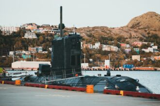
In the intriguing world of espionage, the article “Espionage at Sixteen Thousand Feet Depth” delves into the covert operations that take place beneath the ocean’s surface, revealing the intricate tactics employed by intelligence agencies. For those interested in exploring related themes of secrecy and surveillance, the article available at this link provides further insights into the complexities of modern espionage and its implications on global security.
Technological Thresholds and Deep-Sea Exploration Capabilities
Accessing the abyssal depths of the Mariana Trench requires extraordinary technological prowess. The immense pressures, which can exceed 1,000 standard atmospheres, pose significant engineering challenges for any submersible or autonomous underwater vehicle (AUV). Despite these hurdles, advancements in materials science, robotics, and propulsion systems have enabled increasingly sophisticated deep-sea exploration.
Submersible Technology: Manned vs. Unmanned Systems
Historically, manned submersibles like the Bathyscaphe Trieste and Deepsea Challenger have pushed the boundaries of human presence in the abyss. These iconic vessels demonstrated the feasibility of exploring such extreme environments. However, the operational costs, safety concerns, and inherent limitations of human endurance have spurred the development of unmanned systems. AUVs and remotely operated vehicles (ROVs) can operate for extended periods, gather vast amounts of data, and reach areas inaccessible to manned platforms. Their increasing autonomy and sophistication allow for more covert and persistent surveillance and data collection, significantly enhancing deep-sea operational capabilities.
Sensor Technology and Data Acquisition
The effectiveness of deep-sea exploration, especially for intelligence gathering, hinges on advanced sensor technology. High-resolution sonar systems provide detailed topographical maps of the seabed, identifying features that could be of geological or strategic interest. Magnetometers can detect anomalies in the Earth’s magnetic field, potentially indicating the presence of metallic objects or geological formations. Hydrophones, sensitive acoustic sensors, are crucial for detecting underwater sound signatures, from natural geological events to the faint hum of submerged vehicles. Chemical sensors are also employed to detect unique compositions indicating hydrothermal vents, or even the subtle traces of human activity. The synergy of these diverse sensor suites creates a comprehensive picture of the deep-sea environment, shedding light on both natural phenomena and man-made intrusions.
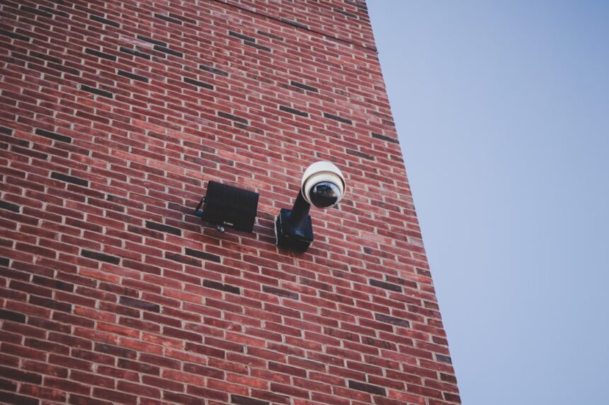
The Veil of Secrecy: Covert Operations in the Deep
Operating at 16,000 feet beneath the ocean’s surface provides an unparalleled level of stealth. The vast expanse of water acts as an impenetrable shield, absorbing radar, obscuring visual detection, and attenuating acoustic signals. This natural cloak of invisibility renders the deep sea an ideal theater for covert operations, where the lines between scientific research and intelligence gathering can often blur.
Dual-Use Technologies and Ambiguous Intentions
Many deep-sea exploration technologies possess dual-use capabilities, meaning they can be employed for both legitimate scientific research and clandestine intelligence activities. A research submersible designed to collect biological samples could simultaneously deploy acoustic sensors to monitor underwater activity. An AUV mapping hydrothermal vents could also be equipped to survey undersea cable routes or detect submerged military assets. This inherent ambiguity makes it challenging to discern the true intentions behind deep-sea expeditions, fueling suspicion and increasing the potential for misinterpretation in an already sensitive geopolitical landscape.
Monitoring Undersea Infrastructure
The undersea communications cables mentioned earlier are not merely data conduits; they are also potential vectors for espionage. Tapping these cables, either directly or through acoustic monitoring of their operational characteristics, could yield invaluable intelligence. Such operations require specialized deep-sea vehicles capable of precise positioning and manipulation, navigating the rugged terrain of the seabed to access these vital arteries. The very act of monitoring these cables, regardless of whether a tap is deployed, constitutes a significant intelligence gathering operation, highlighting the vulnerability of global communication networks.
Geopolitical Implications and International Law
The deep sea, while largely unregulated, is not a legal vacuum. The United Nations Convention on the Law of the Sea (UNCLOS) provides a framework for maritime activities, defining territorial waters, exclusive economic zones (EEZs), and the high seas. However, the extreme depths of places like the Mariana Trench often fall into areas beyond national jurisdiction, governed by the principle of the “common heritage of mankind.” This legal ambiguity, coupled with advancements in deep-sea technology, creates a complex and potentially volatile environment for international relations.
The Challenge of Enforcement and Attribution
One of the significant challenges in the deep sea regarding espionage is the difficulty of enforcement and attribution. Identifying the perpetrator of a covert deep-sea operation is incredibly complex. The absence of traditional monitoring capabilities, the ability of deep-sea vehicles to remain submerged for extended periods, and the dual-use nature of many technologies make it arduous to pinpoint responsibility. This lack of transparency can lead to heightened tensions, as nations may suspect their rivals of engaging in clandestine activities without concrete proof, creating a chilling effect on trust and cooperation.
National Interests and Strategic Competition
Nations with advanced deep-sea capabilities, particularly those with significant economic and strategic interests in the Pacific, are increasingly viewing the Mariana Arc as a critical area for presence. Scientific research can serve as a legitimate veneer for asserting claims, gathering intelligence, and developing advanced deep-sea capabilities. This competition is not merely for resources; it extends to influence, technological superiority, and the ability to project power into previously inaccessible domains. The deep sea, once a scientific curiosity, has become a silent battleground in the ongoing struggle for global dominance.
In exploring the intricate world of espionage, one can delve deeper into the tactics and strategies employed in high-stakes environments, such as those described in the article about espionage at sixteen thousand feet depth. For a broader understanding of the implications and historical context of such covert operations, you might find the related article on intelligence operations quite enlightening. You can read more about it here.
The Future of Deep-Sea Espionage: A Shifting Battlefield
| Metric | Value | Unit | Description |
|---|---|---|---|
| Depth of Operation | 16,000 | feet | Depth at which espionage activities are conducted |
| Water Pressure | 7,200 | psi | Approximate pressure exerted at 16,000 feet underwater |
| Temperature | 2 | °C | Average temperature at 16,000 feet depth |
| Communication Delay | 0.1 | seconds | Estimated signal delay for underwater communication at this depth |
| Equipment Used | Submersible Drones | – | Type of technology deployed for espionage |
| Data Transmission Rate | 500 | kbps | Speed of data transfer from underwater devices |
| Operational Duration | 72 | hours | Maximum continuous operation time for espionage missions |
The trajectory of deep-sea exploration and espionage suggests an intensification of activities in the coming decades. As technology continues to evolve, the capabilities of deep-sea vehicles will become even more sophisticated, enabling longer missions, greater autonomy, and enhanced stealth. The abyssal plains, once considered an unreachable void, are slowly being cataloged and understood, making them accessible playgrounds for shadowy maneuvers.
Autonomous Swarms and AI Integration
The future of deep-sea espionage may involve autonomous swarms of interconnected AUVs, operating collaboratively to survey vast areas of the seabed or conduct complex intelligence-gathering missions. These swarms, guided by advanced artificial intelligence, could exhibit unprecedented levels of stealth and resilience, difficult to detect or counter. AI algorithms could also analyze the vast datasets collected by these vehicles, identifying patterns and anomalies that human operators might miss, thereby gleaning actionable intelligence from the very whispers of the abyss. Think of it as a networked school of robotic fish, each with a specialized sensor, operating in perfect, undetectable synchronicity.
Counter-Espionage Measures and Defensive Strategies
In response to the growing threat of deep-sea espionage, nations are likely to invest in counter-espionage measures. This could involve developing advanced detection systems capable of identifying subtle acoustic, magnetic, or chemical signatures of foreign deep-sea vehicles. Defensive strategies might also include the deployment of autonomous surveillance networks, designed to patrol critical undersea infrastructure or monitor strategic areas. Protecting these fragile subsea lifelines, the digital nerves of global civilization, will become an increasingly important aspect of national security, transforming the silent depths into a new frontier for perpetual vigilance. The silent, cold realm of the deep, once the exclusive domain of extreme biology, is transforming into a high-stakes chessboard, where nations contend for power, information, and the strategic advantage that lies hidden beneath 16,000 feet of water.
STOP: The Fake Mining Ship That Almost Started WW3
FAQs
What is the main focus of the article “Espionage at sixteen thousand feet depth”?
The article explores espionage activities conducted at extreme ocean depths, specifically around sixteen thousand feet below the surface, highlighting the challenges and technologies involved.
Why is espionage conducted at such great ocean depths?
Espionage at great depths is often aimed at monitoring underwater communication cables, military installations, or submarine movements, as these areas are strategic for national security and intelligence gathering.
What technologies are used for espionage at sixteen thousand feet depth?
Advanced submersibles, remotely operated vehicles (ROVs), specialized sensors, and underwater surveillance equipment are typically used to conduct espionage at such extreme depths.
What are the risks associated with espionage at sixteen thousand feet underwater?
Risks include equipment failure due to high pressure, detection by opposing forces, environmental hazards, and the technical difficulty of operating at such depths.
Has espionage at these depths been confirmed by any governments or organizations?
While specific operations are often classified, there have been reports and declassified documents indicating that several governments have engaged in underwater espionage activities at great depths for intelligence purposes.