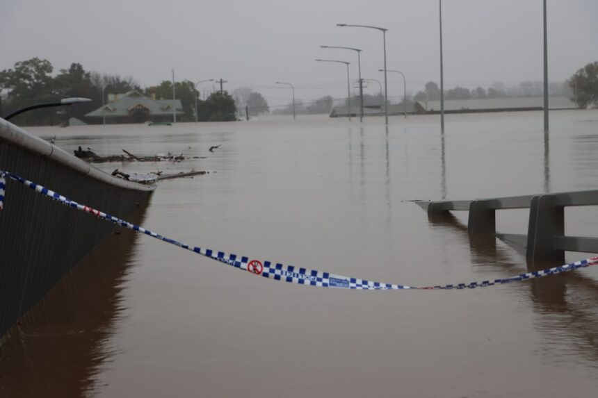
China’s civil defense infrastructure is increasingly focusing on the critical threat of flooding, a phenomenon amplified by changing climate patterns and rapid urbanization. A cornerstone of this preparedness effort lies in the development and utilization of comprehensive inundation maps. These maps serve as vital tools for risk assessment, emergency response planning, and public awareness, aiming to mitigate the devastating impacts of floods on both lives and property.
Flooding in China is not a new challenge, but its frequency, intensity, and geographic reach appear to be changing. Beyond the perennial threats posed by major river systems like the Yangtze and Yellow Rivers, localized flash floods, storm surges along coastal areas, and overflow from urban drainage systems are becoming increasingly significant concerns. The sheer scale of China’s population and its concentration in low-lying areas, particularly along the eastern coast and major river valleys, makes effective flood management a matter of national security and economic stability. Inundation maps provide a standardized and visual framework for understanding these complex risks.
The Shifting Climate and its Impact on Flood Regimes
- Increased Rainfall Intensity: Scientific consensus points towards more extreme weather events, meaning that when rain does fall, it is often in shorter, more intense bursts. This overwhelms natural and man-made drainage systems, leading to rapid flooding.
- Rising Sea Levels: For China’s extensive coastline, rising sea levels exacerbate the threat of storm surges, pushing floodwaters further inland and increasing the duration of inundation.
- Glacier Melt and Snowpack Changes: In the mountainous regions of western China, changes in glacier melt rates and snowpack accumulation can lead to unpredictable increases in river flows downstream, posing a long-term flood risk to a significant portion of the country.
Urbanization and Increased Vulnerability
- Sponge City Imperative: The rapid and extensive growth of Chinese cities has often involved the sealing of natural landscapes with impermeable surfaces like concrete and asphalt. This drastically reduces the land’s capacity to absorb rainwater, channeling it directly into urban drainage systems and leading to flash floods. The “Sponge City” initiative aims to reverse this trend by incorporating green infrastructure, but the legacy of past development continues to pose challenges.
- Population Density: Densely populated urban centers mean that a single flood event can affect a larger number of people, increasing the potential for casualties and displacement.
- Critical Infrastructure in Floodplains: Many vital infrastructure elements, including power plants, transportation hubs, and industrial facilities, have historically been located in areas now recognized as flood-prone. This creates a complex scenario where the disruption of one element can have cascading effects.
The Role of Inundation Maps in Risk Perception
- Visualizing the Unseen: Floods, by their nature, are often temporary events. Inundation maps provide a static, yet scientifically grounded, representation of where floodwaters are likely to extend under different scenarios. This helps policymakers, planners, and the public visualize potential risks that might otherwise seem abstract.
- Informing Land-Use Planning: The data embedded within these maps can directly inform decisions about where new development should be permitted, where existing structures require retrofitting, and where natural flood defenses should be preserved or created.
- Raising Public Awareness and Preparedness: By making the potential impact of floods tangible, these maps can encourage individuals and communities to develop their own emergency plans, identify evacuation routes, and understand their personal risk levels.
In recent discussions surrounding China’s civil defense strategies, the importance of inundation maps has been highlighted as a critical tool for disaster preparedness and response. These maps provide essential information for urban planning and emergency management, helping to identify areas at risk of flooding and other natural disasters. For further insights into this topic, you can read a related article that delves into the implications of these maps on urban safety and infrastructure resilience at this link.
The Science Behind the Maps: Data, Modeling, and Methodology
The creation of accurate and reliable inundation maps is a complex scientific endeavor that relies on a sophisticated interplay of data acquisition, advanced modeling techniques, and rigorous validation processes. These maps are not static representations but dynamic tools that are updated as new data becomes available and understanding of hydrological processes evolves.
Data Acquisition and Management
- Topographic Data: High-resolution digital elevation models (DEMs) are fundamental. These provide the terrain information upon which water will flow. Data is often gathered through aerial surveys, satellite imagery, and ground-based lidar scanning. The accuracy of the DEM directly impacts the precision of the inundation prediction.
- Hydrological Data: This includes historical rainfall records, river flow rates, groundwater levels, and the characteristics of drainage systems. This data is collected from a vast network of monitoring stations across the country.
- Meteorological Forecasts: Real-time and predictive weather data, particularly rainfall forecasts, are critical inputs for dynamic flood modeling.
- Land Cover and Land Use Data: Understanding the type of surface (e.g., forest, urban, agricultural) is essential, as different surfaces have varying hydraulic properties. This data is often derived from satellite imagery and classified.
- Infrastructure Data: Information on roads, bridges, dams, and other critical infrastructure is incorporated to assess their vulnerability and potential impact of flooding.
Hydrological and Hydraulic Modeling
- Rainfall-Runoff Models: These models simulate how rainfall is converted into surface runoff. Factors such as soil type, vegetation cover, and precipitation intensity are considered.
- Riverine Flow Models: These models simulate the movement of water within river channels, taking into account factors like channel geometry, roughness, and upstream inflows. They are essential for predicting river overflow.
- Flood Inundation Models: These are the core models that utilize DEMs and simulated water levels to predict the extent and depth of flooding. They often employ sophisticated numerical techniques to solve the equations of fluid dynamics.
- Storm Surge Models: For coastal areas, these models simulate the impact of wind and atmospheric pressure on sea levels, predicting the extent of inundation from coastal flooding.
- Integrated Modeling Systems: Increasingly, China is employing integrated modeling platforms that combine various model types to provide a more holistic understanding of flood dynamics, from rainfall to inundation. This allows for the simulation of complex scenarios, such as the interaction between riverine flooding and storm surges.
Model Validation and Calibration
- Historical Flood Event Analysis: Models are rigorously tested against past flood events, comparing their simulated inundation extents with observed flood marks and damage records.
- Sensitivity Analysis: This process assesses how changes in input parameters affect the model’s output, helping to identify areas of uncertainty and refine the model’s robustness.
- Expert Review: Hydrologists, engineers, and other relevant experts review the models and their outputs to ensure their scientific soundness and practical applicability.
Types of Inundation Maps and Their Applications
The utility of China’s civil defense inundation maps extends across a spectrum of applications, catering to different levels of decision-making and public engagement. These maps are not a one-size-fits-all solution but are tailored to specific needs and scenarios.
Static, Return-Period Based Maps
These are foundational maps that depict the expected inundation area for a specific flood event probability, often referred to as a “return period” (e.g., a 1-in-100-year flood, meaning an event with a 1% chance of occurring in any given year).
- Hazard Zonation: Identifying areas with different levels of flood risk – low, medium, high, and extreme. This is crucial for informing long-term land-use planning and building code regulations.
- Critical Infrastructure Risk Assessment: Overlaying critical infrastructure footprints onto these maps to identify assets at risk and prioritize protective measures. This includes power grids, water treatment plants, hospitals, and transportation networks.
- Insurance and Financial Risk Assessment: Providing data for insurance companies and financial institutions to assess flood-related risks in property transactions and investments.
- Emergency Preparedness Planning: Serving as a baseline for identifying areas that may require evacuation or special attention during flood events.
Dynamic, Scenario-Based Maps
These maps go beyond static probabilities and can simulate inundation under specific, real-time or projected conditions.
- Real-Time Flood Forecasting: When a flood is imminent, dynamic maps can be generated to show the predicted extent of inundation hour by hour, allowing for more precise and timely evacuation orders.
- Emergency Response Coordination: Providing on-the-ground emergency responders with up-to-date information on the evolving flood situation, aiding in the deployment of resources and the prioritization of rescue efforts.
- Infrastructure Resilience Planning: Simulating the impact of flooding on specific infrastructure components under various extreme scenarios (e.g., a dam breach, a surge event combined with heavy rainfall) to test the effectiveness of existing defenses and identify needs for upgrades.
- Climate Change Impact Projections: Increasingly, these maps are used to project future inundation extents under different climate change scenarios, helping policymakers to plan for long-term adaptation strategies.
Public-Facing Inundation Maps
These are simplified versions designed for public consumption, aiming to raise awareness and promote individual preparedness.
- Property-Level Risk Information: Allowing homeowners and businesses to check the flood risk associated with their specific addresses.
- Evacuation Route Planning: Visualizing potential evacuation routes and identifying areas that might become impassable during a flood.
- Educational Tools: Serving as accessible resources for schools and community groups to learn about flood risks and preparedness measures.
- Citizen Science Integration: In some instances, platforms could be developed to allow citizens to report flood observations, contributing to real-time data and model validation.
The Implementation and Dissemination of Inundation Maps

The effectiveness of China’s inundation maps hinges not only on their scientific accuracy but also on their practical implementation and widespread dissemination. Bridging the gap between sophisticated scientific models and actionable preparedness requires robust institutional frameworks and effective communication strategies.
Institutional Framework and Governance
- Centralized Coordination: The Ministry of Emergency Management (MEM), alongside the Ministry of Water Resources (MWR) and other relevant ministries, plays a crucial role in coordinating the development, standardization, and deployment of inundation mapping initiatives across the country.
- Provincial and Local Responsibility: While national guidelines are established, the implementation and refinement of these maps often fall to provincial and municipal governments, who have a more intimate understanding of local topography, hydrology, and socio-economic conditions.
- Inter-Agency Collaboration: Effective flood management requires seamless collaboration between various agencies responsible for water resources, urban planning, disaster relief, and environmental protection. Inundation maps serve as a common data platform to facilitate this cooperation.
- Data Sharing Protocols: Establishing clear protocols for data sharing between research institutions, government agencies, and potentially the private sector is essential for ensuring that the most up-to-date and comprehensive data is used in map development and updates.
Technological Infrastructure and Platforms
- Geographic Information Systems (GIS): GIS technology is the backbone of inundation mapping. China has invested heavily in developing advanced GIS platforms capable of storing, analyzing, and visualizing vast spatial datasets.
- Cloud Computing and Big Data Analysis: The sheer volume of data required for comprehensive flood modeling and mapping necessitates the use of cloud computing infrastructure and big data analytics capabilities.
- Web-Based Interactive Platforms: Many inundation maps are made accessible through web-based platforms, allowing users to zoom, pan, and query information interactively. This enhances usability and accessibility for a wider audience.
- Mobile Applications: The development of mobile applications that can display inundation maps and provide localized warnings can be a powerful tool for reaching the public, especially during emergency situations.
Dissemination and Public Engagement Strategies
- Official Government Portals: Inundation maps are typically made available through official government websites and disaster management portals, ensuring that the information is authoritative and reliable.
- Integration into Emergency Planning Exercises: These maps are a critical component of drills and exercises conducted by civil defense forces and emergency responders, familiarizing them with potential flood scenarios and response strategies.
- Public Awareness Campaigns: Incorporating inundation map data into public awareness campaigns through media, educational materials, and community outreach programs helps to educate citizens about flood risks and preparedness.
- Training for Local Officials and Cadres: Providing training to local government officials, community leaders, and civil defense cadres on how to interpret and utilize inundation maps is crucial for effective local-level preparedness and response.
- Data Accessibility for Researchers and Developers: Making anonymized or aggregated inundation data accessible to researchers and technology developers can foster innovation in flood modeling, early warning systems, and disaster response technologies.
In recent discussions about urban safety and disaster preparedness, the importance of civil defense inundation maps in China has gained significant attention. These maps play a crucial role in helping communities understand flood risks and implement effective response strategies. For further insights into the implications of such mapping efforts, you can explore a related article that delves into the broader context of disaster management and urban planning. Check it out here: In the War Room.
Challenges and Future Directions in Civil Defense Inundation Mapping
| City | Risk Level | Inundation Area (sq km) | Population at Risk |
|---|---|---|---|
| Shanghai | High | 150 | 2,500,000 |
| Guangzhou | Medium | 100 | 1,800,000 |
| Tianjin | Low | 50 | 900,000 |
Despite significant progress, China’s civil defense inundation mapping efforts face ongoing challenges that require continuous attention and innovation. Addressing these issues will be critical for enhancing the nation’s resilience in the face of escalating flood risks.
Data Gaps and Quality Control
- Coverage and Resolution: While progress has been made, ensuring consistent high-resolution topographic and hydrological data across all regions, particularly in remote or less developed areas, remains a challenge.
- Real-Time Data Integration: Achieving seamless integration of real-time observational data into dynamic flood models is an ongoing endeavor. Ensuring the accuracy and reliability of these real-time feeds is paramount.
- Data Standardization and Interoperability: While efforts are underway, further standardization of data formats and protocols across different agencies and regions will improve interoperability and reduce redundancy.
Model Uncertainty and Uncertainty Communication
- Model Limitations: All hydrological and hydraulic models are simplifications of complex natural processes. Understanding and quantifying these limitations, and communicating them transparently, is vital.
- Communicating Uncertainty to the Public: Effectively communicating the inherent uncertainties in flood predictions to the general public without causing undue alarm or complacency is a significant communication challenge. Maps showing probabilities and ranges of potential inundation are a step in this direction.
- The Need for Continuous Model Improvement: As climate patterns shift and new data becomes available, models need to be continuously updated and refined to maintain their accuracy and relevance.
Addressing the Impacts of Climate Change Projections
- Integrating Future Climate Scenarios: While many maps are based on historical data, there is a growing need to extensively incorporate projections of future climate change impacts, such as increased rainfall extremes and sea-level rise, into inundation mapping.
- Long-Term Adaptation Planning: Inundation maps need to inform robust long-term adaptation strategies, including coastal defense enhancements, wetland restoration, and the development of climate-resilient urban infrastructure.
- Dynamic Risk Assessment for Resilient Infrastructure: Future mapping efforts should focus on dynamic risk assessment that can inform the design and operation of infrastructure to withstand a wider range of unprecedented flood events.
Enhancing Public Engagement and Behavioral Change
- Translating Maps into Actionable Preparedness: The ultimate goal of inundation maps is to drive preparedness. This requires sustained efforts to translate map information into concrete actions by individuals, communities, and businesses.
- Feedback Loops and Citizen Science: Establishing mechanisms for public feedback on the accuracy and usability of inundation maps, and exploring avenues for citizen science contributions, can enhance both the maps and public engagement.
- Tailoring Information to Diverse Audiences: Recognizing that different demographics and communities have varying needs and levels of understanding, information disseminated through inundation maps must be tailored to be relevant and accessible.
International Cooperation and Knowledge Sharing
- Learning from Global Best Practices: Engaging in international collaboration and knowledge sharing with countries that have faced similar flood challenges and developed advanced mapping techniques can accelerate progress.
- Collaborative Research Initiatives: Participating in joint research projects focused on flood modeling, climate change impacts, and disaster risk reduction can foster innovation and build capacity.
By continuing to invest in data acquisition, refine modeling techniques, strengthen institutional frameworks, and prioritize effective dissemination strategies, China’s civil defense inundation mapping efforts can play an increasingly vital role in building a more resilient nation against the growing threat of floods.
FAQs
What are China Civil Defense Inundation Maps?
China Civil Defense Inundation Maps are detailed maps that show the potential areas at risk of flooding in the event of a natural disaster, such as a typhoon or heavy rainfall. These maps are used by local authorities and emergency response teams to plan and prepare for potential flooding scenarios.
How are China Civil Defense Inundation Maps created?
China Civil Defense Inundation Maps are created using advanced modeling and simulation techniques that take into account factors such as topography, rainfall patterns, and existing infrastructure. These maps are continuously updated to reflect changes in the environment and urban development.
What is the purpose of China Civil Defense Inundation Maps?
The purpose of China Civil Defense Inundation Maps is to help local authorities and emergency response teams identify high-risk areas and develop effective evacuation and flood prevention plans. These maps also serve as a tool for urban planning and infrastructure development to mitigate the impact of potential flooding.
How are China Civil Defense Inundation Maps used in emergency situations?
During emergency situations, China Civil Defense Inundation Maps are used to guide evacuation efforts, allocate resources, and coordinate response efforts. These maps provide crucial information for decision-making and help minimize the impact of flooding on communities and infrastructure.
Are China Civil Defense Inundation Maps publicly available?
China Civil Defense Inundation Maps are typically made available to local authorities, emergency response teams, and urban planners. While some information may be publicly accessible, certain details and sensitive data may be restricted to authorized personnel for security and emergency preparedness purposes.