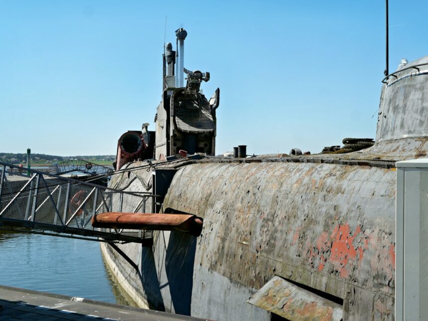
The silent service, a realm where metal behemoths glided through the crushing depths, represented a pinnacle of technological and operational prowess for the Soviet Union. Soviet submarine navigation was not merely about reaching a destination; it was a complex interplay of cutting-edge engineering, rigorous training, and an unwavering commitment to achieving mission objectives in the unforgiving underwater environment. From the early days of diesel-electric pioneers to the nuclear-powered titans of the Cold War, the Soviets continually pushed the boundaries of what was possible, developing unique innovations and techniques to maintain stealth, accuracy, and survivability. This article delves into the multifaceted world of Soviet submarine underwater navigation, exploring the key technologies, operational methodologies, and the underlying philosophy that shaped their approach to silent, unseen transit through the world’s oceans.
Early Pioneers and the Genesis of Underwater Navigation
The initial forays into submarine warfare during the early 20th century, and particularly during World War II, laid the groundwork for the sophisticated systems that would follow. For the Soviet Navy, the challenges were amplified by vast territorial waters and the need to operate in diverse and often unforgiving oceanic conditions. Early submarines, reliant on periscopes and rudimentary compasses, faced significant limitations. The development of more reliable and accurate navigation systems became a paramount concern, directly influencing operational capabilities and strategic deployment. The war itself, with its emphasis on surprise and evasion, underscored the critical role of effective underwater navigation in achieving tactical advantage and minimizing losses.
The Influence of Pre-War and Wartime Experience
The interwar period saw the Soviet Union invest in submarine technology, albeit with varying degrees of success. Designs were often influenced by foreign innovations, but domestic adaptation and development were also crucial. The experience gained during the Great Patriotic War, though often characterized by severe limitations in technology and resources, provided invaluable practical lessons. Submariners learned to navigate by dead reckoning with greater precision, interpret sonar readings for positional cues, and utilize celestial navigation whenever possible, even under challenging conditions. The harsh realities of constant enemy surveillance and the need for absolute stealth instilled a culture of meticulous planning and execution in navigation. The loss of numerous vessels due to navigation errors or detection highlighted the urgent need for advancements.
The Dawn of Sonar and its Navigational Implications
While sonar was primarily developed for offensive and defensive purposes – detecting enemy vessels – its application in navigation was also significant. Early sonar systems, though rudimentary by modern standards, allowed submarines to “see” the underwater terrain, identify submerged obstacles, and even gauge their proximity to shorelines or other underwater features. This passive acoustic sensing became an integral part of a navigator’s toolkit, complementing traditional methods. The ability to identify underwater sound sources, such as distant shipping or even underwater geological activity, could also provide navigational clues. The development of more sophisticated sonar, including active sonar, though its use was carefully managed to maintain stealth, offered greater detail about the surrounding environment and could be used for bathymetric surveys and positional fixes against known seabed features.
Soviet submarine underwater navigation has been a topic of great interest, particularly in understanding the technological advancements and strategies employed during the Cold War. For those looking to delve deeper into this subject, an insightful article can be found at In The War Room, which explores the intricacies of submarine navigation systems and their impact on naval warfare. This resource provides a comprehensive overview of the methods used by Soviet submarines to navigate stealthily beneath the ocean’s surface, highlighting the significance of these technologies in military operations.
The Nuclear Age and Navigational Sophistication
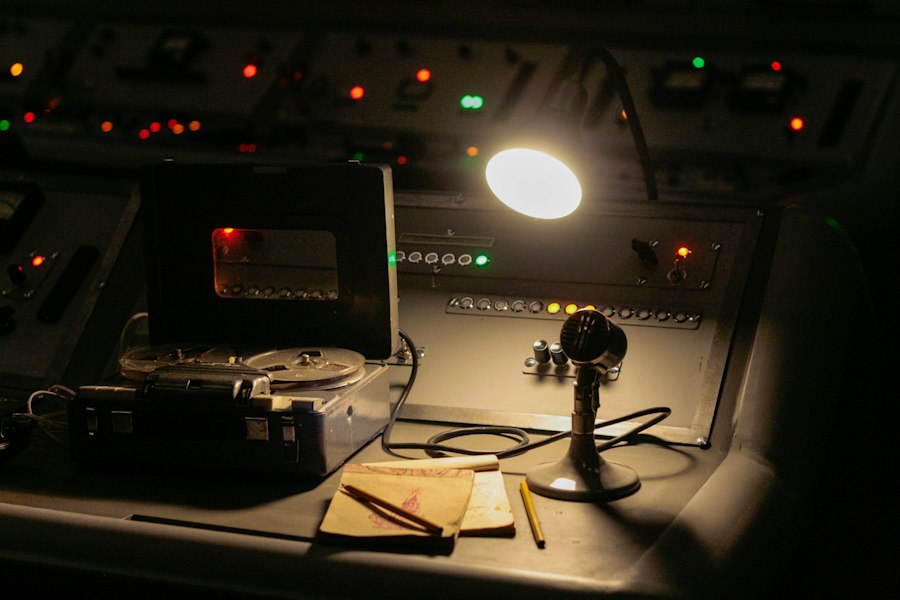
The advent of nuclear-powered submarines in the Soviet Union marked a paradigm shift in operational capabilities, and with it came an imperative for highly advanced navigation systems. The ability to remain submerged for extended periods, traversing vast distances without surfacing, demanded a level of navigational accuracy and autonomy unprecedented in naval history. This era saw the integration of multiple sensor technologies and the development of sophisticated computing power to process and fuse this data, ensuring the submarines could operate effectively and undetected across the globe. The Cold War arms race fueled continuous innovation in this critical domain.
Inertial Navigation Systems: The Core of Autonomy
At the heart of Soviet submarine navigation in the nuclear age lay the Inertial Navigation System (INS). This self-contained system, utilizing gyroscopes and accelerometers, measures the submarine’s acceleration and rotation, allowing it to calculate its position, velocity, and orientation without external references. For submarines, the INS was revolutionary, enabling prolonged submerged operations with a high degree of accuracy. The Soviets invested heavily in developing highly reliable and precise INS units, capable of maintaining accuracy over weeks and months of continuous operation. These systems were often dual or triple redundant to ensure mission success even in the event of component failure. The precision of these gyroscopes and accelerometers, often housed in hermetically sealed, temperature-controlled environments, was a testament to Soviet engineering.
Doppler Sonar and Underwater Terrain Following
Complementing the INS, Doppler sonar systems played a crucial role in refining positional accuracy and providing a real-time understanding of the submarine’s movement relative to the seabed. Doppler sonar emits sound waves and measures the frequency shift of the returning echoes, which directly correlates to the speed of the submarine relative to the seabed. This provided a velocity measurement independent of the INS, allowing for continuous cross-checking and correction. Furthermore, the development of Doppler sonar that could measure the speed relative to water mass added another layer of information for precise maneuvering. By mapping the seabed topography and comparing it to pre-loaded charts, navigators could achieve highly accurate fixes, even in areas with limited external navigational aids. This terrain-following capability was also vital for operating at very low altitudes above the seabed, maximizing stealth.
Celestial Navigation and the Art of the Periscope Fix
Despite the advancements in inertial and sonar navigation, traditional methods retained their importance, especially as a means of recalibrating INS and verifying their accuracy. Celestial navigation, while challenging to perform submerged, was still a fallback option. The brief surfacing of a periscope, even for a fleeting moment, could allow a skilled navigator to obtain a star or sun fix, significantly correcting any accumulated INS drift. These periscope fixes, executed with extreme caution and often under challenging weather conditions, were a testament to the enduring skill of Soviet submariners. The ability to quickly and accurately obtain a celestial fix under duress was a critical skill honed through extensive training.
Enhancing Accuracy and Survivability: Navigational Aids and Techniques
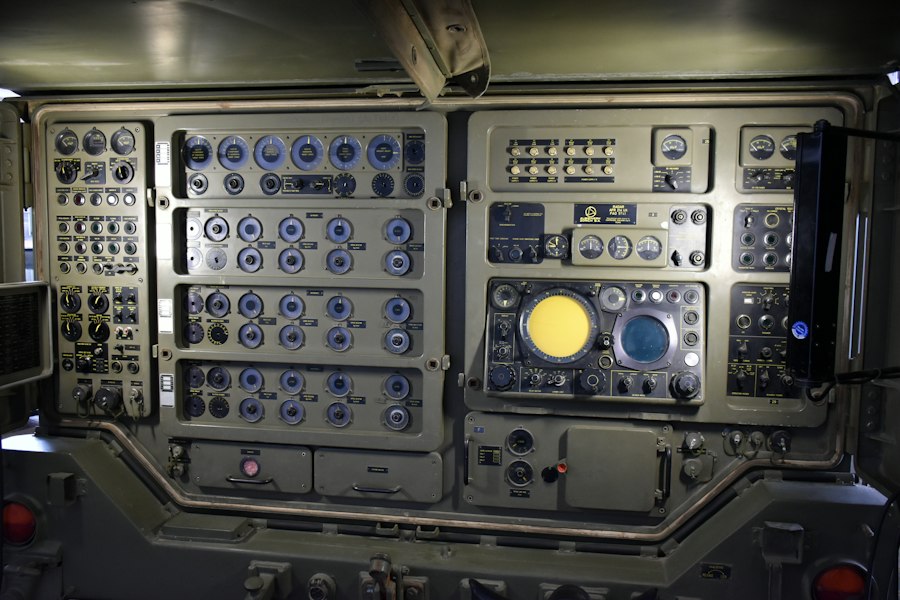
Beyond the core navigation systems, the Soviet Navy developed a range of specialized aids and operational techniques designed to enhance navigational accuracy, improve mission effectiveness, and, crucially, maintain the highest levels of survivability. These innovations often reflected a deep understanding of the operational environment and a proactive approach to mitigating risks. The ability to navigate precisely and stealthily was paramount, as detection often meant mission failure or worse.
Acoustic Mapping and the Underwater Environment
The Soviets recognized the immense potential of understanding and utilizing the acoustic properties of the underwater environment for navigation. This involved not just passive listening but also the active creation of detailed acoustic maps of key operational areas. These maps, often compiled from data gathered by multiple submarines over time, included information on seabed composition, underwater currents, sound propagation characteristics, and known acoustic anomalies. Navigators could then use these maps to correlate their sonar readings with known features, further refining their positional accuracy. This proactive approach to environmental intelligence gathering was a significant innovation.
Deep Water Navigation and the Challenge of Depth
Operating in the deep ocean presented unique navigational challenges. The crushing pressure limited the deployment of certain types of sensors, and the lack of immediate seabed features in abyssal plains made terrain-following navigation difficult. For these scenarios, the Soviets relied heavily on highly precise INS systems, often augmented by sophisticated oceanographic data. Understanding and predicting ocean currents at various depths was also critical, as these could significantly impact a submarine’s track. The development of advanced models to predict and compensate for these currents was a key area of research and development.
Low-Frequency Active Sonar and Navigation
While the use of active sonar was always carefully considered due to the risk of detection, the Soviets developed low-frequency active sonar systems that offered a compromise between navigational utility and stealth. These systems, operating at frequencies less likely to be detected by enemy passive sonar, could be used for bathymetric surveys and to identify larger underwater features. The interpretation of these low-frequency echoes required specialized training and advanced signal processing capabilities. This allowed for a more detailed understanding of the seabed and potential navigational hazards without compromising stealth to the same degree as higher-frequency active systems.
The Human Element: Training and Operational Doctrine
The most advanced technology is only as effective as the crews who operate it. Soviet submarine navigation was underpinned by a rigorous training regimen and a distinct operational doctrine that emphasized discipline, self-reliance, and meticulous planning. The submariners were not merely operators of complex machinery; they were highly skilled navigators who understood the nuances of their environment and the critical importance of their mission.
The Navigator’s Role: Skill and Responsibility
The submarine navigator held a position of immense responsibility. Their training encompassed a broad spectrum of knowledge, from celestial mechanics and hydrography to advanced sonar interpretation and INS operation. They were expected to maintain a constant awareness of the submarine’s position, heading, and speed, as well as the surrounding environmental conditions. The navigator was also responsible for the meticulous planning of every transit, considering factors such as enemy patrols, acoustic conditions, and the tactical objectives of the mission. The daily log of the submarine, detailing its course and any navigational observations, was a critical document meticulously maintained by the navigator.
Operational Doctrine: Stealth and Deception
A cornerstone of Soviet submarine operational doctrine was an unwavering commitment to stealth and deception. Navigational techniques were developed and employed with the primary goal of avoiding detection. This often meant operating at extreme depths, utilizing natural sound channels, and minimizing any detectable emissions. The navigator’s skill in interpreting acoustic signatures and understanding the limitations of enemy detection systems was paramount. The ability to “disappear” into the acoustic background of the ocean was as important as knowing one’s precise location. This often involved complex maneuvering to take advantage of thermoclines or other acoustic barriers.
Simulators and Fleet-Wide Training Exercises
The Soviet Navy invested heavily in advanced simulators to train their crews in a wide range of operational scenarios, including complex navigation challenges. These simulators allowed submariners to practice emergency procedures, hone their skills in adverse weather conditions, and execute intricate maneuvers without the risks associated with live operations. Fleet-wide exercises also played a crucial role, bringing together multiple submarines and surface units to test and refine their coordinated navigation and anti-detection capabilities. These exercises were vital for identifying weaknesses in systems and doctrine and for fostering a cohesive and highly competent naval force.
Soviet submarines were renowned for their advanced underwater navigation techniques, which played a crucial role in their strategic operations during the Cold War. The development of sophisticated sonar systems and inertial navigation methods allowed these vessels to operate stealthily beneath the waves. For a deeper understanding of the technological advancements in submarine navigation, you can explore a related article that delves into these innovations and their implications for naval warfare. Check it out here.
Legacy and Evolution: Enduring Principles in Modern Navigation
| Metric | Description | Typical Value / Range | Notes |
|---|---|---|---|
| Navigation System | Primary underwater navigation technology used | Inertial Navigation System (INS), Doppler Velocity Log (DVL) | INS was the backbone for underwater navigation, supplemented by DVL for velocity measurement |
| Accuracy | Positional accuracy of navigation system underwater | Within 0.1% of distance traveled | Accuracy degrades over time without surface fixes |
| Depth Range | Operational depth for navigation systems | Up to 600 meters (typical for attack submarines) | Navigation systems designed to function at maximum operational depths |
| Speed Measurement | Method to measure submarine speed underwater | Doppler Velocity Log, Pitot tubes | DVL provided accurate speed over ground, critical for navigation |
| Gyroscope Type | Type of gyroscope used in INS | Mechanical and later laser gyroscopes | Transitioned from mechanical spinning mass gyros to more accurate laser gyros in later models |
| Navigation Update Frequency | How often navigation data is updated | Continuous real-time updates | INS provided continuous data; periodic surface fixes used to correct drift |
| Surface Fix Methods | Techniques used to correct INS drift | Radio navigation (LORAN), celestial navigation, GPS (late period) | Early subs used LORAN and celestial fixes; GPS introduced in late Soviet era |
| Autonomy Duration | Duration submarine can navigate underwater without surfacing | Up to 60 days (nuclear-powered) | Navigation systems designed to support long submerged operations |
While the Soviet Union has ceased to exist, the innovations and techniques developed for its submarine navigation continue to influence modern naval practices. The emphasis on self-contained systems, environmental awareness, and the integration of multiple sensor technologies remains a core tenet of submarine navigation worldwide. The lessons learned from the Soviet experience offer valuable insights into the enduring challenges and evolving landscape of underwater operations.
The Persistence of Inertial and Doppler Systems
Inertial Navigation Systems and Doppler Sonar, pioneered and refined by the Soviets for submarine use, remain indispensable components of modern naval navigation. While now augmented by GPS and other satellite-based systems, the inherent autonomy and reliability of INS and Doppler sonar make them crucial for operations where external signals may be unavailable or compromised. The principles of self-contained navigation, where a vessel can determine its position independently, are fundamental to submarine warfare.
The Integration of Sensor Fusion
The Soviet approach to integrating data from multiple sensor sources to achieve a more accurate and robust navigational picture has evolved into the concept of “sensor fusion” in modern systems. This involves combining information from INS, sonar, GPS, and other sources to create a comprehensive and reliable navigational solution. The ability to cross-reference and validate data from different sensors is critical for ensuring navigational accuracy and mitigating the impact of individual system failures or environmental interference.
The Future of Underwater Navigation: Autonomy and AI
The future of underwater navigation is likely to be characterized by increasing levels of autonomy, driven by advancements in artificial intelligence and machine learning. These technologies will enable submarines to make more sophisticated navigational decisions, adapt to rapidly changing environments, and optimize their stealth and operational efficiency. The legacy of Soviet innovation, with its focus on precision, self-reliance, and a deep understanding of the underwater domain, provides a strong foundation for these future developments. The pursuit of ever-greater stealth and accuracy in the silent depths continues to be a driving force in naval technology.

The Soviet Submarine Britain Lost—Then Found Again
FAQs
1. How did Soviet submarines navigate underwater?
Soviet submarines used a combination of inertial navigation systems, sonar, and periscopes to navigate underwater. Inertial navigation systems calculated the submarine’s position based on its previous known position and the direction and speed of its movements. Sonar was used to detect obstacles and other vessels in the water, while periscopes were occasionally used to visually confirm the submarine’s position.
2. Were Soviet submarines able to navigate accurately underwater?
Despite the limitations of technology at the time, Soviet submarines were able to navigate relatively accurately underwater. Inertial navigation systems provided a good estimate of the submarine’s position, while sonar helped detect any potential obstacles. However, factors such as ocean currents and magnetic anomalies could affect the accuracy of navigation.
3. Did Soviet submarines use GPS for underwater navigation?
No, Soviet submarines did not use GPS for underwater navigation. GPS relies on signals from satellites, which cannot penetrate water. Instead, Soviet submarines relied on inertial navigation systems, sonar, and other traditional methods for underwater navigation.
4. How did Soviet submarines communicate while underwater?
Soviet submarines used radio communications while at periscope depth or on the surface. However, while submerged, they relied on acoustic communication systems, such as underwater telephone systems, to communicate with other vessels or command centers. These systems transmitted sound waves through the water to convey messages.
5. What challenges did Soviet submarines face during underwater navigation?
Soviet submarines faced several challenges during underwater navigation, including the risk of detection by enemy vessels or aircraft, the need to avoid underwater obstacles, and the limitations of technology at the time. Additionally, factors such as ocean currents, magnetic anomalies, and the accuracy of inertial navigation systems could all impact the submarine’s ability to navigate effectively underwater.