A Hydrology Survey for Unintended Flooding: An Examination of Causes and Consequences
The phenomenon of unintended flooding, where water inundates areas not typically prone to such events, poses a significant challenge to communities and infrastructure. Understanding the hydrological processes that lead to these occurrences is paramount for effective mitigation and adaptation strategies. A comprehensive hydrology survey serves as a critical tool in this endeavor, providing the data and analysis necessary to identify contributing factors, assess risks, and inform decision-making. This article delves into the intricacies of such surveys, focusing on the scientific principles and practical applications involved in unraveling the complexities of unintended flooding.
The natural hydrological cycle, a continuous process of water movement on, above, and below the surface of the Earth, is inherently dynamic. However, human activities and natural anomalies can disrupt this equilibrium, leading to conditions conducive to flooding. A hydrology survey aims to unravel these disruptions within the context of existing hydrological systems.
Precipitation Patterns and Intensity
Precipitation is the primary driver of most flooding events. Variations in the amount, intensity, and duration of rainfall can overwhelm the natural capacity of the landscape to absorb and manage water.
Analyzing Rainfall Data
- Historical Records Analysis: Examining long-term rainfall records from meteorological stations is crucial. This involves identifying trends in average rainfall, the frequency and intensity of extreme precipitation events, and changes in seasonality. Statistical analysis can reveal deviations from historical norms, such as a significant increase in heavy downpours over a short period.
- Spatial Distribution of Rainfall: Understanding how rainfall is distributed across a given area is vital. Some regions might receive intense rainfall locally, while others experience more widespread, moderate precipitation. This spatial variability influences the localized impact of flooding.
- Rainfall Intensity-Duration-Frequency (IDF) Curves: These curves are fundamental in hydrological design. They represent the relationship between the intensity of rainfall, its duration, and the probability of its occurrence. Surveys often use or develop IDF curves to assess the likelihood of extreme rainfall events that could trigger flooding.
- Drought-Flood Cycles: Some regions exhibit pronounced cycles of drought followed by intense rainfall. Understanding these cycles is important as prolonged dry periods can lead to hardened soil surfaces, increasing runoff when heavy rains eventually occur.
Surface Runoff Dynamics
When precipitation exceeds the infiltration capacity of the soil or the absorption capacity of surface features, water begins to flow over the land as surface runoff. The efficiency of this runoff process is a key determinant of flood severity.
Factors Influencing Runoff Generation
- Soil Type and Permeability: Soil characteristics significantly influence infiltration rates. Impermeable soils, such as dense clay, allow less water to percolate into the ground, leading to higher surface runoff. The survey assesses soil types present within the watershed.
- Topography and Slope: The steepness and shape of the terrain play a critical role in how quickly water flows. Steeper slopes accelerate runoff velocity, increasing the potential for flash floods. Flat areas may experience slower, more persistent inundation.
- Antecedent Soil Moisture Conditions: The amount of water already present in the soil before a rainfall event is crucial. Saturated soils have a reduced capacity to absorb further precipitation, resulting in increased runoff.
- Vegetation Cover: Vegetation acts as a natural sponge, intercepting rainfall, reducing soil erosion, and promoting infiltration. Deforestation, urbanization, or agricultural practices that reduce vegetation cover can significantly increase runoff volumes and velocities.
- Land Use and Land Cover Changes: Urbanization, with its impervious surfaces like roads, rooftops, and parking lots, drastically reduces infiltration and increases the volume and speed of runoff. Agricultural practices, such as plowing fields in particular directions, can also alter natural drainage patterns.
Infiltration and Soil Moisture Storage
Infiltration is the process by which water enters the soil from the surface. Soil moisture is the water held within the soil pores. The capacity of the soil to infiltrate and store water influences how much water eventually becomes surface runoff.
Assessing Infiltration Capacity
- Soil Texture Analysis: Determining the proportion of sand, silt, and clay in the soil helps predict its infiltration characteristics. Sandy soils generally have higher infiltration rates than clayey soils.
- Soil Structure: The arrangement of soil particles (structure) influences the size and connectivity of pores, which impacts water movement. Well-aggregated soils tend to have better infiltration than compacted or platy soils.
- Compaction Effects: Soil compaction, often caused by heavy machinery or foot traffic, reduces pore space and significantly hinders infiltration. This is a common issue in agricultural and urban environments.
- Moisture Deficit and Saturation Levels: Understanding the current soil moisture levels within a watershed is essential. A drier soil has a higher potential to absorb water, while a saturated soil will contribute more to surface runoff.
Evaporation and Transpiration Losses
Evaporation from the soil and water bodies, and transpiration from plants, are processes that remove water from the hydrological system. These losses can influence the total amount of water available for runoff and streamflow.
Quantifying Evapotranspiration
- Climatic Factors: Temperature, humidity, wind speed, and solar radiation all influence evaporation rates. Higher temperatures and wind speeds generally lead to increased evaporation.
- Vegetation Type and Density: Plants with dense foliage and extensive root systems transpire more water than sparse vegetation. The type of crops grown in agricultural areas will also influence transpiration rates.
- Surface Area of Water Bodies: Open water bodies like lakes and reservoirs contribute significantly to evaporation. The surveyed area’s presence of such features is assessed.
- Penman-Monteith Equation: This widely used equation estimates evapotranspiration based on meteorological data and characteristics of the vegetation or water surface.
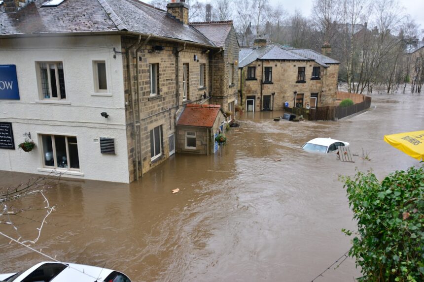
In recent discussions surrounding catastrophic unintended flooding, a relevant article can be found that delves into the complexities of hydrology surveys and their implications for urban planning and disaster management. This article highlights the importance of accurate data collection and analysis in predicting flood risks and mitigating potential damage. For more insights on this topic, you can read the full article here: Catastrophic Unintended Flooding and Hydrology Surveys.
Contributing Factors to Unintended Flooding
Unintended flooding often arises from a confluence of factors, both natural and anthropogenic, that overwhelm the system’s capacity to manage water. A comprehensive hydrology survey meticulously investigates these contributing elements.
Exacerbating Role of Urbanization
The transformation of natural landscapes into urban environments fundamentally alters hydrological processes, frequently leading to increased flooding.
Urban Hydrological Impacts
- Increased Imperviousness: The proliferation of roads, buildings, and paved surfaces creates expansive areas where water cannot infiltrate. This dramatically increases the volume and speed of surface runoff.
- Altered Drainage Systems: While urban areas often have engineered drainage systems (storm sewers), these systems can be overwhelmed during extreme rainfall events. Furthermore, blockages within these systems, due to debris or poor maintenance, can lead to localized flooding.
- Reduced Green Space: The loss of parks, gardens, and vegetated areas diminishes the natural capacity for water absorption and detention within urban environments.
- Channelization and Culvert Design: The straightening and confinement of natural watercourses (channelization) and the use of undersized culverts can impede water flow and create bottlenecks, leading to upstream flooding.
- Compacted Soils in Urban Parks: Even in urban green spaces, soil compaction can reduce infiltration rates compared to undisturbed natural soils.
Impact of Infrastructure Development
Beyond general urbanization, specific infrastructure projects can have profound and often unintended consequences on water flow and flood risk.
Infrastructure and Hydrological Alterations
- Dam and Reservoir Operations: The management of dams and reservoirs, while intended for water management and flood control, can sometimes contribute to unintended flooding. Sudden releases of water, or a failure to adequately pre-release water before a storm, can exacerbate downstream flood conditions. Conversely, the impoundment of water can lead to upstream inundation.
- Road Construction and Embankments: Roads and railway embankments can act as barriers to natural water flow, diverting water and potentially creating impoundments that lead to flooding in adjacent areas.
- Bridge and Culvert Sizing: Inadequate sizing of bridges and culverts is a recurring issue. If the designed capacity of these structures is less than the peak flow of a watercourse during an extreme event, they can become blockages, leading to upstream flooding and potential structural failure.
- Underground Utilities: The installation of underground utilities can sometimes disrupt natural drainage paths or lead to localized settling, creating areas where water can accumulate.
Agricultural Practices and Land Management
Certain agricultural methods, while intended to improve productivity, can inadvertently increase flood susceptibility.
Agricultural Influences on Runoff
- Monoculture and Tillage: Extensive areas of a single crop (monoculture) and intensive plowing can lead to soil degradation and reduced infiltration. Deep tillage can disrupt soil structure, making it more prone to erosion and runoff.
- Drainage Ditches and Tile Drains: While designed to remove excess water from agricultural fields, these systems can sometimes divert large volumes of water rapidly into downstream watercourses, potentially overwhelming them.
- Livestock Grazing: Overgrazing can lead to soil compaction and loss of vegetation cover, increasing runoff.
- Irrigation Practices: Inefficient irrigation can lead to waterlogging and increased salinity, impacting soil permeability.
Natural Anomalies and Extreme Weather Events
While human activities can exacerbate flooding, extreme natural events remain potent triggers.
Natural Triggers for Flooding
- Extreme Rainfall: Unprecedented rainfall amounts over short periods, often associated with thunderstorms or tropical systems, can overwhelm any drainage system.
- Rapid Snowmelt: In regions with significant winter snowpack, unseasonably warm temperatures or heavy rainfall on snow can lead to rapid melting and substantial runoff, causing floods.
- Storm Surges: Coastal flooding is often exacerbated by storm surges, where atmospheric pressure and strong winds push seawater inland, inundating low-lying areas.
- Tsunamis: While rarer, tsunamis can cause catastrophic coastal flooding, driven by seismic activity or underwater landslides.
- Landslides and Debris Flows: Large landslides that obstruct or dam natural watercourses can lead to sudden dam-break floods further downstream.
Survey Methodologies and Data Collection
A thorough hydrology survey employs a range of scientific methodologies and relies on the systematic collection of diverse data types to accurately assess flood risk.
Topographical and Geomorphological Analysis
Understanding the physical contours and features of the landscape is fundamental to predicting how water will flow.
Mapping and Assessing the Land
- Digital Elevation Models (DEMs): These models provide a detailed, three-dimensional representation of the terrain, allowing for the identification of elevation, slope, and topographic depressions where water can accumulate.
- Lidar (Light Detection and Ranging): Lidar technology can generate highly accurate topographic data, even through dense vegetation, providing unparalleled detail for flood modeling.
- Geomorphic Mapping: This involves identifying landforms and their evolution, such as river channels, floodplains, terraces, and alluvial fans, which provide insights into historical flooding patterns.
- Soil Surveys: Detailed soil maps and field assessments are crucial for understanding infiltration rates and the susceptibility of the land to erosion.
Hydrometric Data Acquisition
Direct measurements of water flow and levels are essential for calibrating models and validating findings.
Measuring Water’s Movement
- Stream Gauging Stations: These stations continuously monitor streamflow (discharge) and water levels at various points along watercourses.
- Rainfall and Meteorological Data: As mentioned previously, this includes data from rain gauges, weather radar, and meteorological stations to understand precipitation patterns.
- Groundwater Monitoring: Measuring groundwater levels and fluctuations provides insight into the interconnectedness of surface and subsurface water systems.
- Water Quality Sampling: While primarily focused on flood dynamics, water quality data can sometimes reveal sources of pollutants or sediment that may be exacerbated by flooding.
Hydraulic Modeling and Simulation
Once data is collected, sophisticated models are used to simulate water flow and predict flood inundation extents.
Predicting Flood Behavior
- One-Dimensional (1D) Hydraulic Models: These models simulate water flow in a single dimension, typically along the length of a river or channel. They are useful for estimating water levels and flow velocities within the main channel.
- Two-Dimensional (2D) Hydraulic Models: These models simulate water flow in two dimensions across a floodplain or inundation area, providing a more detailed representation of flood extent and depth.
- Coupled 1D/2D Models: These models combine the strengths of both approaches, allowing for detailed simulation of flow within channels and expansive inundation of the surrounding floodplain.
- Model Calibration and Validation: It is crucial to calibrate hydraulic models using observed historical flood data to ensure their accuracy. Validation involves comparing model predictions with independent data sets.
Remote Sensing and GIS Applications
Modern survey techniques leverage advanced technologies for efficient data collection and analysis.
Utilizing Advanced Technologies
- Satellite Imagery: Satellite data can be used to map land cover, monitor changes in vegetation, and even detect flood extents after an event.
- Aerial Photography: High-resolution aerial photographs provide detailed views of the landscape, useful for identifying features related to drainage and potential flood pathways.
- Geographic Information Systems (GIS): GIS is an integrated platform for managing, analyzing, and visualizing spatial data. It is indispensable for combining different datasets (topography, land cover, hydrometric data) to create comprehensive flood hazard maps.
Identifying Critical Flood Pathways and Vulnerable Areas
A primary objective of a hydrology survey is to pinpoint precisely where and how unintended flooding is likely to occur and to identify the areas and infrastructure most susceptible to damage.
Delineating Floodplains and Flood Zones
Establishing the boundaries of areas prone to flooding is fundamental to risk assessment and spatial planning.
Defining Flood-Prone Regions
- Historical Flood Extents: Mapping the areas inundated during past flood events provides direct evidence of flood susceptibility.
- Reconstructed Flood Events: Using hydraulic models and available data, scientists can reconstruct the potential extent of flooding for various return periods (e.g., 100-year flood, 500-year flood).
- Hazard Mapping: This involves creating maps that depict the probability and severity of flooding in different areas, often categorizing zones by risk level.
- Inundation Depth and Velocity Mapping: Detailed maps showing the expected depth and speed of floodwaters are essential for assessing the potential impact on different structures and populations.
Assessing Infrastructure Vulnerability
Beyond natural landscapes, the survey must evaluate how built environments will fare during flood events.
Evaluating Impact on Structures and Systems
- Building Elevation and Floodproofing: Assessing the elevation of buildings relative to projected flood levels and identifying existing floodproofing measures.
- Critical Infrastructure Assessment: Identifying and prioritizing essential facilities such as hospitals, schools, power substations, and transportation networks that are vulnerable to disruption.
- Road and Bridge Capacity: Analyzing the design capacity of roads and bridges against predicted flood flows to identify potential failure points or impassable routes.
- Drainage System Capacity: Evaluating the capacity of urban storm sewer systems and rural drainage networks to handle anticipated runoff volumes.
- Utility Network Resilience: Assessing the vulnerability of power lines, water mains, and telecommunication networks to flood damage.
Identifying Flow Concentration Zones and Bottlenecks
Understanding where water gathers and its movement is key to predicting overflow points.
Pinpointing Areas of Concern
- Topographic Depressions: Natural low-lying areas that have the potential to accumulate water.
- Channel Confluences: Points where multiple streams or rivers merge, leading to increased flow volumes.
- Constricted Watercourses: Sections of rivers or streams that are narrowed by natural features or artificial structures, potentially leading to increased water levels upstream.
- Undersized Culverts and Bridges: As previously noted, these structures can act as significant bottlenecks.
- Drainage System Outlets and Inlets: Points where water enters or exits engineered drainage systems, which can become overwhelmed or blocked.
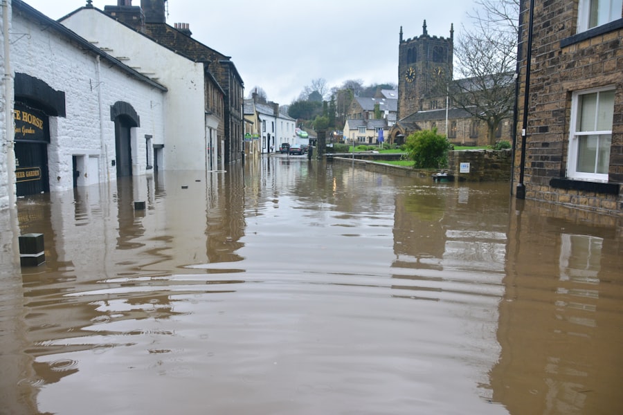
Recent studies have highlighted the importance of understanding the hydrology behind catastrophic unintended flooding events, emphasizing the need for comprehensive surveys to assess risk factors and improve preparedness. For a deeper insight into this critical topic, you can explore a related article that discusses innovative approaches to flood management and mitigation strategies. This resource can be found at this link, which provides valuable information for researchers and policymakers alike.
Mitigation and Adaptation Strategies informed by Survey Findings
| Location | Severity | Affected Area | Cause |
|---|---|---|---|
| City A | High | Residential area | Poor drainage system |
| City B | Medium | Commercial district | Heavy rainfall |
| City C | Low | Industrial zone | River overflow |
The ultimate purpose of a hydrology survey is to provide the evidence base for effective planning and action to reduce flood damages and enhance community resilience.
Engineering Solutions for Flood Control
Based on survey findings, specific engineering interventions can be implemented to manage water flow and reduce flood risk.
Designing Protective Measures
- Levees and Floodwalls: Constructing barriers along rivers and coastlines to contain floodwaters. The design and placement of these structures must be informed by detailed inundation modeling.
- Detention and Retention Basins: Creating artificial reservoirs to temporarily store excess runoff during peak events, releasing it gradually afterwards.
- Channel Modifications and Enlargement: Widening or deepening existing river channels to increase their capacity to carry water.
- Diversion Channels and Spillways: Constructing alternative pathways for floodwaters to bypass vulnerable areas.
- Permeable Pavement and Green Infrastructure: Implementing design features in urban areas that promote infiltration and reduce runoff, such as permeable paving materials, green roofs, and rain gardens.
Land Use Planning and Zoning Regulations
Survey results directly influence how land is used and developed within flood-prone areas.
Guiding Development Decisions
- Floodplain Zoning: Restricting or regulating development in areas identified as high-risk flood zones. This may involve prohibiting new construction or requiring specific building standards.
- Setback Requirements: Establishing minimum distances that new structures must be located from rivers, streams, or coastlines.
- Open Space Preservation: Designating flood-prone areas as open space, parks, or natural reserves to absorb floodwaters and reduce development pressure.
- Relocation and Buyout Programs: For existing structures in highly vulnerable areas, voluntary relocation or property buyout programs may be considered.
Early Warning Systems and Emergency Preparedness
Proactive measures that alert communities to impending floods are critical for saving lives and reducing damage.
Enhancing Community Readiness
- Flood Forecasting and Monitoring: Establishing networks of sensors and data analysis systems to predict flood events and provide timely warnings.
- Public Awareness Campaigns: Educating the public about flood risks, evacuation procedures, and preparedness measures.
- Emergency Response Planning: Developing comprehensive plans for evacuation, shelter, and emergency services in the event of a flood.
- Communication Protocols: Establishing clear and effective communication channels between authorities and the public during flood emergencies.
Nature-Based Solutions for Flood Resilience
Increasingly, surveys highlight the benefits of utilizing natural processes and ecosystems for flood management.
Leveraging Natural Systems
- Wetland Restoration: Creating or restoring wetlands, which act as natural sponges, absorbing significant volumes of floodwater and slowing its flow.
- Reforestation and Afforestation: Planting trees in upstream areas can help stabilize soil, reduce erosion, and increase infiltration.
- Riparian Buffer Restoration: Re-establishing vegetation along riverbanks to help stabilize them, filter runoff, and provide flood attenuation.
- Green Infrastructure Integration: Incorporating natural elements like rain gardens, bioswales, and permeable surfaces into urban and suburban development to mimic natural water management processes.
In conclusion, a hydrology survey is an indispensable scientific undertaking for comprehending and addressing the complexities of unintended flooding. By meticulously analyzing hydrological processes, identifying contributing factors, and employing advanced methodologies, these surveys provide the critical information necessary to develop effective mitigation and adaptation strategies, ultimately safeguarding communities and infrastructure from the pervasive impacts of uncontrolled water.
FAQs
What is catastrophic unintended flooding?
Catastrophic unintended flooding refers to a sudden and severe flooding event that occurs as a result of human activities or natural disasters. This type of flooding can have devastating impacts on communities, infrastructure, and the environment.
What is hydrology?
Hydrology is the scientific study of the movement, distribution, and quality of water on Earth. It encompasses the study of water in the atmosphere, on the Earth’s surface, and underground. Hydrologists use various methods to analyze and understand the behavior of water in the environment.
What is a hydrology survey?
A hydrology survey is a comprehensive assessment of the water resources in a specific area. It involves collecting and analyzing data related to precipitation, surface water flow, groundwater levels, and water quality. The survey helps to understand the hydrological processes and make informed decisions about water management and infrastructure development.
What are the causes of catastrophic unintended flooding?
Catastrophic unintended flooding can be caused by a variety of factors, including heavy rainfall, dam or levee failures, urbanization and land use changes, deforestation, and climate change. Human activities such as improper land development and inadequate infrastructure can also contribute to the risk of unintended flooding.
How can hydrology surveys help mitigate the risk of catastrophic unintended flooding?
Hydrology surveys provide valuable data and insights that can be used to assess the potential for flooding, develop flood risk maps, design effective flood control measures, and improve water resource management. By understanding the hydrological processes in a specific area, decision-makers can take proactive steps to mitigate the risk of catastrophic unintended flooding.