The frigid, seemingly immutable surface of Antarctica belies a dynamic and complex underworld, largely concealed beneath vast expanses of ice and a veil of frigid, often turbulent ocean waters. For centuries, human understanding of this submerged terrain has been constrained by the inherent challenges of observation in such an extreme environment. However, the advent and refinement of multibeam sonar technology has begun to peel back the layers of mystery, offering unprecedented insights into the bathymetry, geology, and ecology of Antarctica’s continental shelves, ice-fronts, and deep ocean basins. This article explores how multibeam sonar is instrumental in navigating and understanding the submerged parts of the Antarctic continent.
Multibeam sonar, a sophisticated acoustic imaging system, operates by emitting multiple beams of sound energy in a fan shape from a transducer mounted on a vessel or an autonomous underwater vehicle (AUV). These beams strike the seabed at various angles, and the time it takes for the reflected sound to return to the transducer is measured. By analyzing these travel times and the angle of the beams, a detailed, three-dimensional map of the seafloor topography can be constructed. Unlike older single-beam sonars that provide a single depth reading directly beneath the vessel, multibeam systems acquire data across a wide swath, significantly increasing survey efficiency and the resolution of the acquired data.
The Technological Foundation
The basic principle of sonar (Sound Navigation and Ranging) has existed for decades, initially developed for military applications. However, the evolution to multibeam technology represents a significant leap forward. Modern multibeam systems utilize advanced signal processing techniques to filter out noise, correct for variations in sound velocity caused by temperature and salinity, and achieve remarkable accuracy in depth measurements. The transducer arrays themselves have become more complex, allowing for wider coverage patterns and higher frequencies that can resolve finer seafloor features.
From Single Beam to Swath: A Paradigm Shift
The transition from single-beam echo sounders to multibeam systems was transformative. Early seafloor mapping relied on single beams, requiring extensive parallel track lines to cover an area, which was time-consuming and often left gaps in the data. Multibeam sonars, by surveying a wide swath, drastically reduce survey time and provide a much more contiguous and high-resolution dataset, enabling the creation of detailed bathymetric charts.
Environmental Considerations and Data Acquisition
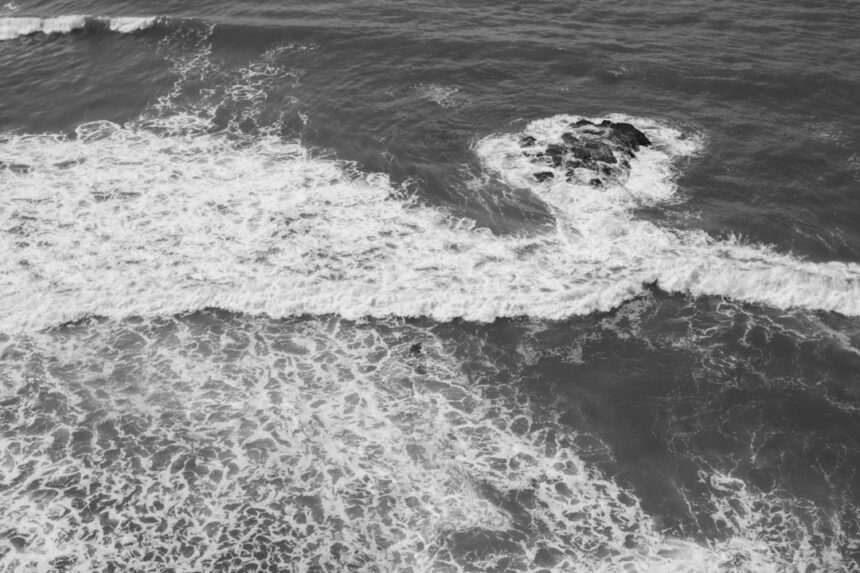
Operating multibeam sonar in Antarctica presents unique environmental challenges. The presence of sea ice can restrict vessel access to certain areas, requiring specialized ice-strengthened ships or the deployment of AUVs. The cold water temperatures and potential for strong currents can affect acoustic propagation and the performance of the sonar system. Rigorous calibration procedures are essential to ensure data accuracy. Furthermore, minimizing the acoustic footprint of research vessels is a growing concern, given the potential impact of noise on marine life.
Applications in Antarctic Research
The precise topographic data generated by multibeam sonar is invaluable for a wide range of scientific disciplines focused on Antarctica. It provides the foundational framework upon which other research is built.
Bathymetric Mapping and Charting
The most direct application is the creation of detailed bathymetric maps. These maps are critical for navigation, particularly in the often poorly charted Antarctic waters. Beyond navigation, they provide vital information for understanding ocean circulation patterns, identifying potential fishing grounds, and locating suitable sites for scientific research stations or underwater observatories.
Geological Investigations
The seafloor topography recorded by multibeam sonar offers significant clues about the underlying geology. Features such as seamounts, trenches, submarine canyons, and volcanic ridges are readily identifiable. These features can inform studies on plate tectonics, the history of glaciation (through glacial lineations and moraines on the seabed), and the processes of sediment transport and deposition.
Ice-Ocean Interaction Studies
Antarctica’s ice shelves and glaciers are a major driver of global sea-level rise. Multibeam sonar plays a crucial role in studying the interaction between glaciers and the ocean, particularly at their grounding lines and beneath floating ice shelves. By mapping the seafloor topography at the base of glaciers, scientists can better understand melt rates, basal ice dynamics, and the potential for calving events.
Multibeam sonar technology plays a crucial role in enhancing submarine routing in the challenging waters of Antarctica, allowing for more accurate mapping of the seafloor and identification of underwater hazards. For further insights into the applications and advancements in this field, you can explore a related article that discusses various aspects of maritime navigation and technology. Check it out here: related article.
Exploring the Ice Front: Unveiling Hidden Landscapes
The seaward edge of Antarctica’s massive ice sheets, known as ice fronts or ice shelves, represents a dynamic interface where ice meets the ocean. Multibeam sonar is now being deployed to map the complex and often hazardous environments beneath these floating ice masses, revealing features that have remained hidden from direct observation.
Mapping Sub-Ice Shelf Bathymetry
Beneath the thick, floating ice shelves, the seafloor can be incredibly varied. Multibeam sonar surveys conducted from beneath the ice, typically using AUVs, have revealed deep troughs, steep slopes, and the erosional features carved by the passage of ice. These features are critical for understanding how ocean currents flow beneath the ice shelves, influencing melting and the stability of the ice.
Submerged Glacial Valleys
Many Antarctic glaciers terminate in deep troughs that extend onto the continental shelf. Multibeam sonars have mapped these submerged valleys with remarkable clarity, revealing their dimensions, their extent, and the presence of sediment deposits within them. This information helps scientists reconstruct the past behavior of glaciers and predict their future retreat.
Iceberg Plough Marks and Glacial Moraines
The movement of icebergs and glaciers across the seafloor can leave distinct imprints. Multibeam sonar can detect these features, such as iceberg plough marks and glacial moraines. The distribution and characteristics of these features provide insights into the recent history of ice sheet dynamics and the forces that shape the Antarctic seafloor.
Investigating Iceberg Grounding Events
Large icebergs can become grounded on the seafloor, creating significant disturbances. Multibeam sonar surveys can identify areas where grounding has occurred and assess the extent of seafloor modification. This information is important for understanding sediment transport and the potential for habitat disturbance.
The Impact of Grounded Icebergs on the Seabed
When icebergs ground, they can scour the seafloor, rearranging sediments and potentially damaging benthic ecosystems. By mapping these areas before and after grounding events, scientists can quantify the impact and study the recovery processes.
Characterizing the Continental Shelf: A Foundation for Understanding

The Antarctic continental shelf is a vast and diverse underwater region that plays a critical role in global oceanographic and ecological processes. Multibeam sonar has revolutionized our ability to map and characterize its complex topography.
Revealing the Geological History of the Shelf
The seafloor of the Antarctic continental shelf is a record of its geological evolution, shaped by tectonic forces, volcanic activity, and, most significantly, the repeated advances and retreats of glaciers during past ice ages. Multibeam sonar can identify features such as fault scarps, volcanic edifices, and extensive glacial landforms.
Glacial Landforms: Evidence of Past Ice Sheets
The retreat of large Antarctic ice sheets has left behind a wealth of glacial landforms on the continental shelf. These include terminal moraines, drumlins, mega-ripples, and ice-scoured channels. The detailed bathymetry provided by multibeam sonar allows for the precise mapping and interpretation of these features, offering crucial insights into the extent and behavior of past ice sheets.
Sedimentary Processes and Environments
Multibeam sonar can also detect variations in seafloor texture and composition, which can be inferred from acoustic backscatter intensity. This allows researchers to identify different sedimentary environments, such as areas of fine mud deposition, coarse gravel, or exposed bedrock. Understanding these processes is vital for studying sediment transport, nutrient cycling, and the distribution of marine organisms.
Identifying Habitats for Marine Life
The physical structure of the seafloor, as revealed by multibeam sonar, is a primary determinant of habitat availability for benthic organisms. Steep slopes, rocky outcrops, and the presence of features like canyons can create unique ecological niches.
Correlation with Biological Surveys
Multibeam sonar data is frequently integrated with biological surveys, such as underwater video transects or grab sampling. This allows scientists to correlate the presence of specific marine communities with particular seafloor geomorphologies and sediment types, leading to a more comprehensive understanding of benthic ecosystems.
Potential for New Discoveries
The ability to map previously inaccessible areas of the continental shelf with high resolution increases the likelihood of discovering new geological or biological features and habitats. This is particularly true in remote and less-explored regions of Antarctica.
Deep-Sea Exploration: Peering into the Abyss
Beyond the continental shelf, the Antarctic seabed plunges into the abyssal plains and deep ocean trenches. Multibeam sonar systems, especially those deployed on specialized research vessels or aboard AUVs designed for deep-sea operations, are extending our knowledge into these extreme environments.
Mapping Trenches and Basins
Antarctica is bordered by significant oceanic trenches, such as the South Sandwich Trench. Multibeam sonar is crucial for mapping the bathymetry of these deep features, understanding their geological origins, and studying the unique ecosystems that may exist within them. Similarly, the broad abyssal plains and basins surrounding the continent are being charted, providing a fundamental understanding of large-scale ocean floor morphology.
Understanding Oceanographic Features
The detailed bathymetry derived from multibeam sonar in deep-sea areas helps scientists understand how deep-ocean currents flow, how sediments are transported over vast distances, and how these features may influence global oceanographic circulation.
Studying Seamounts and Hydrothermal Vents
While less common than in some other ocean basins, seamounts exist in the Southern Ocean. Multibeam sonar can detect these underwater mountains, which can be formed by volcanic activity. Furthermore, ongoing research aims to employ multibeam sonar for the initial detection and mapping of potential hydrothermal vent sites, which are oases of life in the deep ocean.
The Potential for Hydrothermal Vent Discovery
The unique geological setting of the Southern Ocean suggests the potential for undiscovered hydrothermal vent systems. Multibeam sonar, with its ability to survey wide areas and identify subtle seafloor anomalies, is a key tool in the initial reconnaissance for these scientifically significant sites.
Recent advancements in multibeam sonar technology have significantly improved submarine routing in the challenging waters of Antarctica. This innovative approach not only enhances navigation safety but also aids in mapping the seafloor, providing crucial data for scientific research and environmental monitoring. For a deeper understanding of how these technologies are being utilized in polar regions, you can explore this insightful article on submarine operations and their implications for marine exploration at In The War Room.
Challenges and Future Directions
| Depth Range (m) | Distance Covered (km) | Mapping Resolution (m) |
|---|---|---|
| 0-500 | 150 | 5 |
| 500-1000 | 200 | 10 |
| 1000-2000 | 250 | 15 |
Despite the transformative impact of multibeam sonar, significant challenges remain in navigating and understanding Antarctica’s submerged terrain. Continued technological advancements and innovative survey strategies are essential for future progress.
Overcoming Environmental Hurdles
The persistent presence of sea ice continues to be a major impediment to year-round access and survey operations in many Antarctic regions. Developing more robust ice-penetrating sonar technologies or enhancing the capabilities of AUVs for prolonged ice-covered operations are crucial areas of development.
Ice-Tolerant Sonar Systems
Research is ongoing into sonar systems that can operate effectively despite the presence of sea ice, either by being mounted on ice-strewn vessels or by employing novel acoustic techniques that can penetrate or circumvent ice.
Autonomous Underwater Vehicles (AUVs) for Extended Missions
The use of AUVs is becoming increasingly important for gathering data in areas inaccessible to surface vessels. Enhancing the endurance, navigation capabilities, and sensor payloads of AUVs will enable more comprehensive surveys of sub-ice environments and remote deep-sea regions.
Data Integration and Analysis
The sheer volume of data generated by multibeam sonar surveys requires sophisticated processing and analysis techniques. Developing standardized workflows and leveraging artificial intelligence and machine learning tools can accelerate the interpretation of bathymetric data and its integration with other datasets, such as geophysical, geological, and biological information.
High-Resolution Data Processing
The increasing resolution of multibeam sonar systems necessitates advanced processing capabilities to handle the large datasets efficiently and extract meaningful information about fine-scale seafloor features.
Cross-Disciplinary Data Fusion
Effectively integrating multibeam sonar data with other scientific datasets is critical for building a holistic understanding of the Antarctic marine environment. This includes combining bathymetry with seismic data, magnetic surveys, sedimentological analyses, and biological observations.
Expanding the Surveyed Footprint
Vast areas of the Antarctic seafloor remain unmapped or are mapped at very low resolutions. Future efforts will focus on expanding the geographic coverage of high-resolution multibeam sonar surveys, particularly in less-explored regions of the Southern Ocean and beneath key Antarctic ice shelves. The focus is increasingly shifting towards targeted surveys of areas critical to understanding climate change impacts, such as the grounding zones of major ice sheets and areas of significant seabed ice-ocean interaction. The ability of multibeam sonar to provide the foundational topographic data is thus central to many of the most pressing scientific questions facing Antarctica today.
FAQs
What is multibeam sonar technology?
Multibeam sonar technology is a type of sonar system that uses multiple beams of sound to create a three-dimensional image of the seafloor. It is commonly used for mapping the ocean floor and identifying underwater features.
How is multibeam sonar used for submarine routing in Antarctica?
Multibeam sonar is used for submarine routing in Antarctica to map the seafloor and identify safe routes for submarines to navigate through the icy waters. This technology helps to avoid underwater obstacles and hazards, ensuring safe passage for submarines.
What are the benefits of using multibeam sonar for submarine routing in Antarctica?
Using multibeam sonar for submarine routing in Antarctica allows for accurate mapping of the seafloor, which is essential for identifying safe navigation routes. This technology helps to minimize the risk of underwater collisions and ensures the safety of submarines operating in the region.
Are there any limitations to using multibeam sonar for submarine routing in Antarctica?
While multibeam sonar technology is highly effective for mapping the seafloor, it may have limitations in certain conditions, such as extreme depths or areas with complex underwater topography. Additionally, environmental factors such as ice cover and water temperature can impact the performance of multibeam sonar.
What are the future developments in multibeam sonar technology for submarine routing in Antarctica?
Future developments in multibeam sonar technology for submarine routing in Antarctica may focus on improving the resolution and accuracy of seafloor mapping, as well as enhancing the system’s ability to operate in challenging environmental conditions. Additionally, advancements in autonomous underwater vehicles (AUVs) equipped with multibeam sonar may further enhance submarine routing capabilities in Antarctica.