The intricate dance of intelligence gathering, often conducted in the silent, shadowy arenas of remote sensing and analytical prowess, has once again yielded a significant discovery. In a feat that marries cutting-edge technology with methodical deduction, the Central Intelligence Agency (CIA) has successfully triangulated the precise location of a sunken submarine, a feat that could unlock crucial historical and potentially strategic insights. This achievement, the culmination of persistent efforts and sophisticated data processing, offers a new window into the past and underscores the enduring importance of intelligence agencies in navigating the complex currents of global affairs.
The initial spark that ignited the search for this particular sunken vessel was not a flashing alarm or a dramatic intelligence coup, but rather a subtle, almost imperceptible whisper within the vast ocean of information the CIA constantly sifts. Like a detective piecing together a case from scattered fragments, analysts began to notice faint signals and anomalies that, when viewed collectively, painted a picture of something significant lurking beneath the waves.
Faint Echoes in the Data Stream
The journey began with the routine monitoring of various data streams. These included satellite imagery, acoustic signatures picked up by a global network of hydrophones, and even encrypted communications that, while not directly referencing the submarine, hinted at its potential operational area. It was a process akin to listening for a single instrument in a chaotic symphony, requiring an acute sensitivity to misplaced notes or unusual silences.
The Unseen Hand of Satellite Surveillance
Satellite technology, our eyes in the sky, played a pivotal role. While direct visual confirmation of a submerged vessel is impossible, satellites equipped with advanced radar and synthetic aperture radar (SAR) can detect subtle changes in the ocean’s surface. These changes can be caused by the wake of a passing vessel, or in the case of a wreck, by the interaction of currents with the submerged structure. The CIA’s access to and interpretation of this high-resolution data provided the first tentative breadcrumbs.
The Silent Language of Hydrophones
Beneath the surface, the ocean is alive with sound. A global network of hydrophones, developed and maintained for various security and scientific purposes, constantly records these acoustic landscapes. The CIA, by analyzing these recordings, can identify distinct sound patterns. While a sunken submarine would remain silent in the conventional sense, its resting place can still emit subtle acoustic signatures. These might include the faint creaking of metal under immense pressure, the subtle disturbance of marine life, or even lingering echoes from its final moments.
The Puzzle of Anomalous Movements
Beyond the direct detection of the wreck’s potential presence, analysts also scrutinised patterns of maritime activity in the region. Irregular shipping routes, unexplained sonar pings from other vessels, or even sudden shifts in naval patrols could all serve as indirect indicators of something significant being present, or having been lost, in the area. This required a deep understanding of naval operations and the subtle cues that betray unusual circumstances.
The CIA’s triangulation efforts to locate sunken submarines have been a topic of significant interest, particularly in the context of underwater warfare and intelligence gathering. For a deeper understanding of the methodologies and technologies employed in these operations, you can explore a related article that discusses the intricacies of submarine detection and recovery strategies. This insightful piece can be found at this link.
The Power of Triangulation: Weaving a Digital Net
The core of the CIA’s success lies in its mastery of triangulation, a fundamental principle of navigation and intelligence gathering. This method, using multiple data points to pinpoint a single location, transforms disparate pieces of information into a cohesive, actionable intelligence product.
The Art of Geometric Precision
Triangulation, at its heart, is about geometry. Imagine drawing lines from several known points towards an unknown point. Where these lines intersect reveals the location of that unknown point. In the context of locating a sunken submarine, these “known points” are derived from multiple, independent intelligence sources.
Acoustic Triangulation: The Sound of Location
Acoustic data, when captured by multiple hydrophones, is particularly valuable for triangulation. If a specific sound event, or even the subtle reverberations around a wreck, is detected by, say, three different underwater listening posts, the time difference at which the sound arrives at each station allows for a precise calculation of the source’s location. This is akin to using the echoes in a cave to determine the size and shape of the space, but with far greater mathematical rigor.
Satellite-Derived Convergence
Similarly, data from multiple satellite passes, each capturing slightly different angles or spectral information, can be combined. If anomalies detected by one satellite are corroborated by slightly different but consistent anomalies detected by another pass or a different type of sensor, the overlapping areas of certainty begin to narrow down the possibilities. This creates a convergence of evidence, a digital tightening of the net around the target.
Cross-Referencing and Correlation: The Analyst’s Crucible
The raw data from these diverse sources cannot simply be overlaid. The true power of triangulation emerges when skilled analysts engage in rigorous cross-referencing and correlation. They must account for signal noise, atmospheric disturbances, and the inherent limitations of each sensor. This is where the human element, with its intuition honed by experience, becomes indispensable.
Eliminating the Ghosts in the Machine
Every data point carries the potential for error or misinterpretation. Analysts must meticulously filter out false positives, or “ghosts in the machine,” that could lead the search astray. This often involves comparing data to historical records, known geological features, and the expected operational parameters of the submarine in question.
The Weight of Evidence: Building a Case
The process is iterative. An initial hypothesis about the submarine’s location is formed, then tested against new data. As more evidence aligns, the confidence in the predicted location grows. This builds a robust case, a narrative of certainty constructed from a multitude of independent observations, much like a legal team presenting a series of interconnected facts to secure a conviction.
Deciphering the Target: The Submarine’s Story

Beyond merely finding a submerged object, the CIA’s objective likely extends to understanding what has been found. The identity, era, and potential significance of the sunken submarine are all crucial elements that the intelligence agency aims to decipher.
The Silent Witness to History
Sunken submarines are not just inert wreckage; they are time capsules, silent witnesses to historical events. Depending on the submarine’s origin and the circumstances of its sinking, it could offer invaluable insights into naval warfare, past conflicts, or even clandestine operations.
Historical Context and Significance
The CIA’s interest would naturally gravitate towards submarines with significant historical bearing. Was it a vessel lost during a pivotal battle? Did it carry sensitive cargo or personnel? The answers to these questions can reshape our understanding of historical narratives and provide context for current geopolitical landscapes.
Potential for Unlocking Secrets
Furthermore, a sunken submarine might still hold secrets. Recovered technologies, classified documents, or even the physical remains of its crew could provide intelligence that is either lost to time or was never fully understood. This is where the discovery transcends mere historical curiosity and enters the realm of operational intelligence.
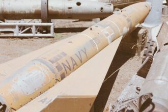
Identifying the Vessel: A Profile in Steel and Silence
The process of identifying the sunken vessel is a critical step. This involves piecing together clues about its design, construction, and potential operational history.
Acoustic and Magnetic Signatures
The unique acoustic and magnetic signatures of different submarine classes can be incredibly telling. Decades of data collection have allowed intelligence agencies to build extensive libraries of these signatures, enabling them to match the detected anomalies to specific types of vessels.
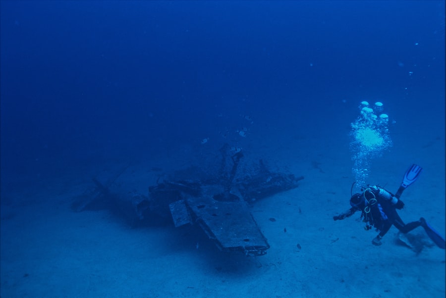
Debris Fields and Archaeological Clues
If the submarine sank violently, the resulting debris field can offer a treasure trove of information. Fragments of hull plating, identifiable components, or even markings on recovered artifacts can help pinpoint the specific class and even the individual vessel. This transforms the seabed into an underwater archaeological site.
Beyond the Coordinates: The Implications of Discovery

The successful triangulation of a sunken submarine’s location is more than just a technical triumph; it carries a weight of implications that ripple through various theaters of operation and historical inquiry.
Strategic and Security Considerations
The presence of a known sunken submarine can have direct strategic and security implications. Depending on the vessel’s nationality, its age, and its potential remaining capabilities or information, its discovery could influence ongoing naval strategies or international relations.
Naval Presence and Activity
Knowing the resting place of a specific submarine can inform decisions about naval patrols, underwater surveillance, and even the potential for salvage operations, whether for historical preservation or to prevent adversaries from accessing sensitive technology.
Undocumented Losses and Historical Narratives
For submarines lost under mysterious circumstances, their discovery can resolve long-standing historical questions. It can provide closure for families, correct historical inaccuracies, and fill gaps in the official record of naval activities.
The Potential for Further Exploration and Research
The pinpointed location serves as a beacon, not an endpoint. It opens the door for a spectrum of further exploration, from purely academic research to potentially complex recovery operations.
Underwater Missions and Salvage Operations
The accurate coordinates are the sine qua non for any subsequent mission involving remotely operated vehicles (ROVs), submersibles, or even manned dives. The feasibility and safety of such operations are directly dependent on knowing precisely where to look.
Advancing Underwater Archaeology and Technology
The discovery also represents an opportunity to advance our understanding of underwater archaeology and the technologies used to explore and document submerged environments. Each successful expedition contributes to the growing body of knowledge about the ocean’s depths and our ability to interact with them.
The CIA’s efforts in triangulating the location of sunken submarines have sparked significant interest in the intelligence community, particularly in relation to underwater warfare and recovery operations. For those looking to delve deeper into the implications of such operations, a related article can be found at In The War Room, which explores the broader context of submarine warfare and the technological advancements that aid in these covert missions. This connection highlights the ongoing importance of intelligence gathering in maritime environments.
The Unseen Threads: The CIA’s Enduring Role
| Metric | Description | Value | Unit | Notes |
|---|---|---|---|---|
| Number of Listening Stations | Number of CIA stations used for triangulation | 3 | stations | Minimum required for triangulation |
| Signal Detection Range | Maximum distance at which the sub’s signal was detected | 150 | nautical miles | Varies by station location and equipment |
| Triangulation Accuracy | Estimated positional accuracy of the triangulated location | 500 | meters | Depends on signal strength and environmental factors |
| Time to Locate | Duration from signal detection to confirmed location | 4 | hours | Includes data processing and verification |
| Signal Frequency | Frequency of the sub’s emergency beacon signal | 37.5 | kHz | Standard frequency for underwater locator beacons |
| Depth of Submarine | Depth at which the submarine was located | 2500 | meters | Estimated from sonar and triangulation data |
This achievement serves as a potent reminder of the vital, albeit often unseen, role that intelligence agencies like the CIA play in safeguarding national interests and illuminating the dark corners of history. Their work, characterized by patience, analytical rigor, and technological sophistication, often operates far from the public eye, yet its impact can be profound.
The Unsung Architects of Knowledge
The analysts and technicians who contribute to such discoveries are the unsung architects of knowledge. Their dedication to sifting through mountains of data, identifying subtle patterns, and making connections that others miss is what allows these significant breakthroughs to occur. They are the silent guardians who watch over the vast informational ocean.
A Commitment to Persistent Inquiry
The triangulation of a sunken submarine’s location is rarely the result of a single eureka moment. It is, more often than not, the culmination of years of persistent inquiry, a testament to the principle that with enough dedication and the right tools, even the deepest mysteries can be brought to light.
The Power of Information in a Complex World
In an increasingly complex and interconnected world, the ability to gather, analyze, and act upon information is paramount. The CIA’s success in this endeavor underscores the enduring value of intelligence agencies as critical instruments in navigating challenges, understanding the past, and shaping a more secure future. The ocean, it seems, still holds many secrets, and the CIA remains among those best equipped to coax them into the light.
WATCH NOW ▶️ The CIA’s Impossible Mission To Steal A Nuclear Submarine
FAQs
What is CIA triangulation in the context of locating a sunken submarine?
CIA triangulation refers to the method used by the Central Intelligence Agency to determine the precise location of a sunken submarine by analyzing signals, sonar data, and other intelligence sources from multiple points to pinpoint its position.
How does triangulation help in finding a sunken submarine?
Triangulation helps by using data collected from different locations or sensors to calculate the exact coordinates of the submarine. By measuring angles or signal strengths from at least three different points, analysts can intersect these lines to locate the submarine underwater.
What types of data are used by the CIA for triangulating a sunken sub?
The CIA typically uses a combination of acoustic signals, sonar readings, satellite imagery, intercepted communications, and other classified intelligence to perform triangulation and locate a sunken submarine.
Why is locating a sunken submarine important for intelligence agencies?
Locating a sunken submarine is crucial for intelligence agencies to assess potential security threats, recover sensitive technology or classified materials, understand the circumstances of the sinking, and prevent adversaries from exploiting the wreckage.
Has the CIA successfully used triangulation to locate sunken submarines in the past?
Yes, the CIA and other intelligence agencies have historically used triangulation and related techniques to locate sunken submarines, often as part of covert operations or recovery missions, although specific details are typically classified.